Disclosure : This site contains affiliate links to products. We may receive a commission for purchases made through these links.
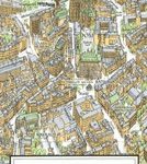
Zurich VBZ City Map
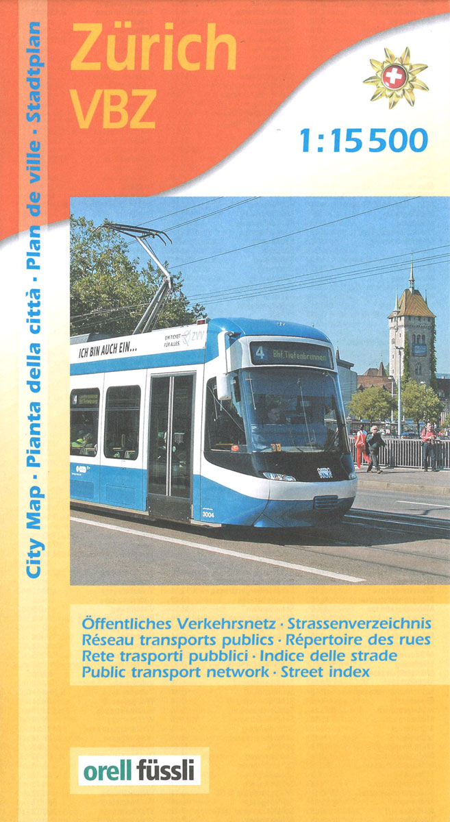
Zurich VBZ city map is an indexed, official city map of Zurich’s public transport network at a scale of 1:15,000. Stations, transport lines, stops and termini, route numbers, ticket offices, parking facilities, car hire locations and taxi ranks are all fore grounded against a fainter displayed city plan. This map features bus and tram ways on VBZ Zuri lines, regional lines and post bus lines, as well as S-Bahn and RER rail lines, cable/funicular railways, ZSG boat cruises and ferry routes. Camping sites, shopping centres, places of worship, post offices, monuments, museums and theatres are all vividly superimposed against the city backdrop, as well as the more specific local interest of shooting range locations.A more detailed city centre street plan at a scale of 1:10,000 is provided as an insert, with clear indications of the many one way streets to be navigated.

Related Products:
 Zurich
 Zurich Street Atlas
 Dublin City Centre Tourist Map
 Zurich Hallwag 3in1 City Map
 Zurich Pocket Plan
 Zurich Panorama Plan
 Zurich PopOut
 Zurich & Switzerland NW ITMB
 Riga City Center Jana Seta Street Plan
 Budapest City Plan
 Bangkok Marco Polo City Map
 Athens F&B City Pocket Map
 Only in Zurich: A Guide to Unique Locations, Hidden Corners and Unusual Objects
 Liege Michelin City Plan 99
 Zurich Oberland
 Hong Kong Marco Polo City Map
 Mexico Central & Mexico City ITMB
 Lisbon Michelin City Plan and Index
 Zurich Unterland – Winterthur K+F Hiking Map 08
 Ghent Michelin City Plan 41
 Zurich Pocket Street Atlas
 London Michelin City Map
 Singapore Periplus Travel Map
 Istanbul Marco Polo City Map
 Zurich K+F Cycling Map 6
 Zurich Once and Today Swisstopo Map No. 304
 Bucharest Street Atlas
 Vienna F&B Tourist Street Plan
 San Francisco Borch
 Buenos Aires Borch
 Palma de Mallorca Michelin City Map
 Cape Town Marco Polo City Map
 Lisbon F&B
 Zurich K+F Hiking Map 6
 Lake Zurich
 – Lake Zug K+F Hiking Map 13
Lake Zurich
Lake Zurich – Lake Zug K+F Hiking Map 13
 New York City Borch
 Wiener Neustadt F&B
 Old City of Jerusalem Map
 Kuwait & Kuwait City ITMB