Map and Travel Bookshop
We offer a huge range of maps, travel books and other travel accessories.
-
New Products
-

Persian Poems
Still little known in the West, Persian poetry offers extraordinary riches. While celebrating the beauty of the world in poems about love, wine and poetry itself, Read More » -

Lonely Planet Germany
Lonely Planet`s Germany is your passport to the most relevant, up-to-date advice on what to see and skip, and what hidden discoveries await you. Explore the Read More » -

Eritrea Bradt Guide
A new, thoroughly updated edition of the essential guide for independent travellers to this unusual and remarkable African country. All the information needed for a successful Read More » -

Ullared Lantmateriet 530
Topographic survey of Sweden at 1:50,000, the Terrรคngkartan, from the Lantmรคteriet, covering most of the country in 244 double-sided maps. Please note: the mountainous regions of Read More » -
Bath, Marshfield and the Vale of Avon 1912
Bath, Marshfield and the Vale of Avon in 1912 in a series of reproductions of Ordnance Survey’s famous “Inch to the Mile” maps published in the Read More » -
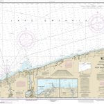
NOAA Chart 14806 – Thirtymile Point, New York, to Port Dalhousie, Ontario – Olcott – Wilson Harbor
NOAA maintains the nautical charts and publications for U.S. coasts and the Great Lakes. Over a thousand charts cover 95,000 miles of shoreline and 3.4 million Read More » -

1421 The Year China Discovered The World
On 8 March 1421, the largest fleet the world had ever seen set sail from China. The ships, some nearly five hundred feet long, were under Read More » -

The Chamber of Ten: A Novel of the Hidden Cities
From two masters of dark fantasy comes a chilling tale of magic and possession, set in-and beneath-fabulous Venice, a city slowly being swallowed by the very Read More » -
London Bridges
-

Lokka
The 1:50,000 topographic map gives a more general picture of the ground features than a basic map. It shows settlements, houses, roads, cultivated areas, waterways, cutting Read More »
-
-
Featured Products
-

Explorations in the Pacific
-
Agios – Nikolaos – Ierapetra: 2017
-

Ukkusiksalik National Park, Nunavut
Ukkusiksalik National Park in Nunavut at 1:375,000 in a series of GPS compatible recreational maps at various scales from Go Trekkers highlighting recreational possibilities including trekking Read More » -

The Hunt Seattle
Heading to Seattle, but want to do more than visit the Space Needle and hit up the original Starbucks? Allow The Hunt team to help you Read More » -

The End of Time
Beneath the stars, on a stony beach, stand two teenage brothers.They are wearing lifejackets that are too big for them and their most precious belongings are Read More » -

The Dragon with a Chocolate Heart
Aventurine is the fiercest, bravest kind of dragon, and she`s ready to prove it to her family by leaving the safety of their mountain cave and Read More » -

Granta 134: No Man`s Land
-
SHOM Chart 5281 – Port de Bizerte et goulet du lac
PLEASE NOTE: the chart will be ordered for you if not currently in stock. Please allow 1-2 weeks for the chart to reach Stanfords. SHOM charts Read More » -
Mykonos In 3 Hours – Cruiser`s Map & Guide
-
Hawaii Recreational Atlas & Gazetteer
Hawaii Recreational Atlas & Gazetteer at 1:84,000 approx. in a series of large format paperback state atlases from DeLorme, with detailed, contoured, GPS compatible topographic mapping, Read More »
-
Categories
-
Best Sellers
-
CHS Chart 7770 – Spence Bay and Approaches
The official Canadian charts provide an excellent range of scales for the whole length of Canada`s coastline as well as the Great Lakes and comply with Read More » -
Island Peak – Mera Peak
Two peaks of Nepal’s western Himalayas, Island Peak (Imja Tse) and Mera Peak, presented by Swiss publishers Climbing Map on separate contoured and GPS compatible panels Read More » -

SalzAlpenSteig: Chiemsee – Kรถnigssee -Halstรคtter See
The SalzAlpenSteig, a 227km-long hiking trail linking Chiemsee in southern Bavaria with Halstรคtter See in the Salzkammergut region of the Austrian Alps. The route, including alternative Read More » -
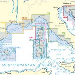
NV Charts – Croatia and Montenegro Chart Atlases
-

South Pembrokeshire OS Explorer Map OL36 (paper)
The southern coast of Pembrokeshire on a detailed topographic and GPS compatible map OL36, paper version, from the Ordnance Survey’s 1:25,000 Explorer series. Coverage includes Pembrokeshire Read More » -
Sasamon CNIG Topo 199
-
Olduvai and Laetoli
-

Pompeii: The Living City
This startling new book concentrates on the twenty years between 59 and 79AD, thus beginning with the earthquake which all but destroyed Pompeii and ending with Read More » -
Picture Storybooks
-


