Disclosure : This site contains affiliate links to products. We may receive a commission for purchases made through these links.
Zug
Street plan of Zug at 1:6,000, with public transport, one way streets, car parks, places of interest, etc. Map legend and general information on the town itself include English.On the reverse, the communities around the northern part of the Zuger See are shown at a less detailed scale of 1:12,000, with public transport network, hiking trails and cycling routes in the area. Map legend of this plan is in German only.The map also includes a diagram of public transport in the entire Zuger See area and a general road map at 1:350,000 stretching from Lake Lucerne to Schaffhausen and Lake Constance.

Related Products:
 Linz F&B Tourist Street Plan
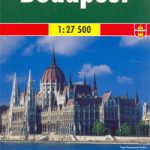 Budapest F&B
 Hong Kong Marco Polo City Map
 Nuremberg City Pocket Plan
 Munich Falk Cityplan
 Munich Marco Polo City Map
 Munich F&B
Locarno – Ascona
Munich F&B
Locarno – Ascona
 Munich F&B Wall Map
Nuremberg Falk EXTRA Street Plan
Munich F&B Wall Map
Nuremberg Falk EXTRA Street Plan
 Munich F&B Wall Map – with Metal Hanging Strips
 Salzburg F&B Street Plan
 Salzburg F&B Tourist Street Plan
 Frankfurt Marco Polo City Map
 Vienna F&B
 Tisza Lake Cartographia Water Sports & Cycling Map
 Zurich
 Munich & Bavaria ITMB
 Riga City Center Jana Seta Street Plan
 Dresden City Pocket Plan
 Hamburg City Pocket Plan
 Cologne City Pocket Plan
 Stuttgart City Pocket Plan
 Leipzig City Pocket Plan
 Cape Town Marco Polo City Map
 Kiel City Pocket Plan
 Lubeck City Pocket Plan
 Munster City Pocket Plan
 Potsdam City Pocket Plan
 Bremen City Pocket Plan
 Dortmund City Pocket Plan
 Innsbruck City Map
 Dรผsseldorf City Pocket Plan
 Bangkok Marco Polo City Map
 Mariazell F&B
 Lake Balaton II West Cartographia Water Sports & Cycling Map
Bremen Falk EXTRA Street Plan
Hanover Falk EXTRA Street Plan
Lake Balaton II West Cartographia Water Sports & Cycling Map
Bremen Falk EXTRA Street Plan
Hanover Falk EXTRA Street Plan
 Porto Michelin City Plan and Index
 Lubeck Falk Special Fold Plan