Disclosure : This site contains affiliate links to products. We may receive a commission for purchases made through these links.
Zlatibor
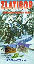
Zlatibor and the surrounding region at 1:100,000 on road map from the Belgrade based Geokarta, with a list of hotels, plus on the reverse an aerial photo of the town overprinted with various local tourist facilities.On one side of the map is a relatively small, 35 x 35 cm, road map at 1:100,000 centered on Zlatibor showing the network of local roads and cart tracks. Local towns and villages have icons indicating what facilities can be found there, including accommodations, restaurants/bars, petrol stations, car repairs, etc. All place names are in the Latin alphabet only. The map has no geographical coordinates. Accompanying panel provides a list of hotels with contact details, bus routes, etc. Also provided are extensive notes illustrated by colour photos.The whole of the reverse side is taken by an aerial photo of Zlatibor itself. Streets have no names. Icons indicate locations of various tourist facilities.Map legend and all the text are only in Serbo-Croatian.

Related Products:
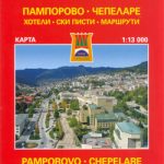 Smolyan – Chepelare – Pamorovo and the Surrounding Area
 Kamianets-Podilskyi Kartografiya Street Plan
 South Africa F&B
 South-Western Nicaragua – Masaya – Granada
 Divcibare and Environs
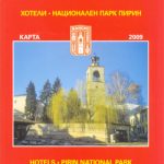 Bansko (with Pirin National Park)
 Bucegi Mountains
 Iceland F&B
 Auckland Kiwimaps City & District Pathfinder Map
Mallorca – Serra de Tramuntana
Auckland Kiwimaps City & District Pathfinder Map
Mallorca – Serra de Tramuntana
 Berne Once and Today Swisstopo Map No. 301
 Geneva Once and Today Swisstopo Map No. 303
 Zurich Once and Today Swisstopo Map No. 304
 Basel Once and Today Swisstopo Map No. 302
 Lesbos Geopsis 211
Mallorca – Alcudia – Playa de Muro – C`an Picafort
Lesbos Geopsis 211
Mallorca – Alcudia – Playa de Muro – C`an Picafort
 Kootenay National Park Gem Trek Map
 Lebanon – Beirut Reise Know-How
Mallorca – Pollenca – Port de Pollenca – Alcudia – Port d`Alcudia – Can Picafort
Lebanon – Beirut Reise Know-How
Mallorca – Pollenca – Port de Pollenca – Alcudia – Port d`Alcudia – Can Picafort
 Irkutsk
 Catalonia Tourist Road – Regional Divisions Map
Kabul & Historic Khyber Pass ITMB
Catalonia Tourist Road – Regional Divisions Map
Kabul & Historic Khyber Pass ITMB
 Tierra del Fuego – Cordillera Darwin – Lago Fagnano – Isla Navarino SIG Patagon
Tasmania Hema
Tierra del Fuego – Cordillera Darwin – Lago Fagnano – Isla Navarino SIG Patagon
Tasmania Hema
 Northland: Whangarei, Dargaville, Wellsford, Warkworth
 Fiordland: Milford Sound, Te Anu, Manapouri, Otautau
 Auckland – Coromandel: Thames, Hamilton, Tauranga
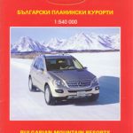 Bulgaria (with Mountain Resorts)
 South East Queensland Hema
 Bangladesh & India East ITMB
 Menorca
 Easter Island / Rapa Nui
 Durban MapStudio Pocket Map
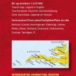 Lofoten and Vesteralen Islands
 Southern Lakes: Queenstown, Wanaka, Cromwell, Alexandra
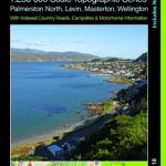 Wellington – Wairarapa: Palmerston North, Levin, Masterton
 Taranaki – Ruapehu: New Plymouth, Ohakune, Wanganui, Foxton
 North Westland: Westport, Reefton, Greymouth, Hokitika
 Canterbury: Amberley, Christchurch, Ashburton, Temuka