Disclosure : This site contains affiliate links to products. We may receive a commission for purchases made through these links.
Zimbabwe InfoMap

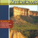
Zimbabwe on a double-side road map from the South African publishers International Motoring Productions with GPS waypoints for selected towns or settlements. The map, one of a series of similar maps covering countries and selected regions of southern Africa, has rather simple cartography with somewhat basic elevation tinting and occasional spot heights. Main rivers (not named) and lakes are marked and protected areas are highlighted.Roads are classified as national, major, minor, and 4WD tracks and show driving distances on main routes and locations of fuel stations. Border crossings to neighbouring countries indicate opening times. Symbols mark various places of interest.Some towns or settlements and important road junctions are annotated with GPS waypoints, although far fewer than on the publishers’ similar maps of other southern African countries. A basic street plan shows central Harare naming mains streets. The map, published in 2005, also includes an ‘Accommodation and Activities Legend” with an extensive list of symbols for various types of accommodation, sport and recreational facilities, etc, none of which appear on the map itself.

Related Products:
 Lesotho InfoMap
 Zambia InfoMap
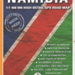 Namibia InfoMap
 Angola InfoMap
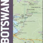
 Botswana InfoMap
 Swaziland
 Mozambique and Malawi
 Kaokoland – North Western Namibia InfoMap
 South Africa: InfoMap Touring Maps
 Cape West Coast – Cederberg & Tankwa Karoo InfoMap
 Zimbabwe Map Studio Adventure Map
 Damaraland
 South Africa InfoMap
 Richtersveld National Park and Northern Namaqualand
 Transkei Wild Coast
 Megaliesberg – Pilanesberg and the Waterberg
 Drakensberg and the Eastern Free State
 Kruger National Park
 Africa Map Studio Road Atlas
 Lesotho Map Studio Adventure Map
 Namibia Map Studio Adventure Map
Garden Route & Route 62 Map Studio
Namibia Map Studio Adventure Map
Garden Route & Route 62 Map Studio
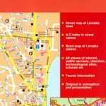 Larmaka Street Plan and District Road Map
 Botswana Map Studio Adventure Map
 Zimbabwe Reise Know-How
 Cusco & Peru South ITMB
 Zimbabwe National Parks Map
 Waikato Towns and District Pathfinder
 South Africa – Namibia – Botswana – Zimbabwe Nelles
 New Plymouth and Taranaki Towns Pocket Map
 Northland: Whangarei, Bay of Islands and 61 Provincial Towns Pathfinder
 Malawi Map Studio Adventure Map
 Finland Road Atlas GLOVEBOX, SPIRAL-BOUND
 Coromandel Pocket Map
 Tauranga – Bay of Plenty Pathfinder
 Palmerston North Pathfinder
 Whangaparaoa and Orewa Pocket Map
 Zurich & Switzerland NW ITMB
 Dunedin, Mosgiel, Oamaru and Otago Towns Pocket Map