Disclosure : This site contains affiliate links to products. We may receive a commission for purchases made through these links.
Zakynthos Terrain Editions 355
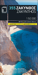
Zakynthos on a light, waterproof and tear-resistant map from Terrain Editions, combining contoured mapping of the island at 1:50,000 with a street plan of Zakynthos Town and extensive bilingual notes about the island.On one side is a map of the whole island with its topography shown by contours at 100m intervals and altitude colouring. Road network distinguishes between smooth and rough dirt roads, gives driving distances on small local roads, and shows locations of petrol stations and car repair shops. Scenic routes are highlighted. Symbols mark various places of interest including campsites and selected hotels, sandy or pebble beaches, sea caves, etc. Place names are in both Greek and Latin alphabets. The map has a 5-km UTM grid plus latitude and longitude crosshairs at 3’ intervals. Map legend includes English.On the reverse is a street plan at 1:3,000 of Zakynthos Town indicating various tourist facilities and places of interest. Larger streets are in both scripts; minor streets are in Greek alphabet only. The map also includes extensive bilingual Greek/English notes about the island.


