Disclosure : This site contains affiliate links to products. We may receive a commission for purchases made through these links.
Yukon & Northwest Territories South West ITMB
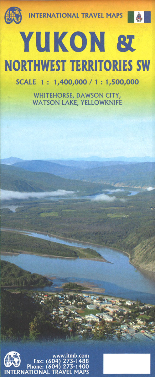
Canada’s Yukon Territory at 1:1,000,000 on a double-sided map from ITMB with altitude colouring to show its topography, plus street plans of White Horse, Dawson City and Watson Lake annotated with hotels and other facilities.The map divides Yukon north/south with a generous overlap between the sides. Altitude colouring with bands in feet shows the topography, with plenty of names of mountain ranges, etc. Peak heights are given in metres. Roads are annotated, where appropriate, with the likely seasonal closure months and winter only tracks are included. The map gives driving distances in both miles and kilometres and shows locations of petrol stations and border crossings to Alaska. Also marked are local airstrips and float plane bases. Symbols indicate places with tourist accommodation including RV grounds and campsites. Coverage includes the adjoining regions of Northwest Territories to show road access to Inuvik, Tuktoyaktuk, and the hiking trail from the Macmillan Pass to Norman Wells. Latitude and longitude lines are drawn at 1ยฐ intervals. Each side has a separate index. Also provided is a distance table plus street plans of White Horse, Dawson City and Watson Lake annotated with hotels and other facilities.To see other maps is this series please click on the series link.

Related Products:
 Northwest Territories ITMB
 Western & Northern Canada ITMB Travel Atlas
 San Diego & USA South West Border ITMB
 Seattle & Northwest USA ITMB
 Rocky Mountains Canada and US ITMB
 Accra & Ghana South ITMB
 South West Wales 110K Sustrans Cycle Map No. 13
 Cuba West ITMB
 Tanzania ITMB
 South East Asia ITMB
 Guangzhou & China South ITMB
 Africa Northwest ITMB
 Mexico ITMB
 Sao Paulo & Brazil South Coast ITMB
 Pan-Americana North ITMB Travel Atlas: Alaska to Panama
 Sikkim & India Northeast ITMB
 Burkina Faso & Niger ITMB
 Paraguay – Bolivia South ITMB
 Iran & Tehran ITMB
 Togo & Benin ITMB
 South America North ITMB
 Cape Verde & West Africa ITMB
 Ho Chi Minh City / Saigon & Vietnam South ITMB
 South America ITMB
 San Francisco & Northern California ITMB
 Mongolia ITMB
 Southern Vietnam – Mekong Delta ITMB
 Aulavik National Park, Northwest Territories
 South America Southern ITMB
 Devon South Sustrans Cycle Map 2
 Bangkok & Thailand South ITMB
 Nigeria & Niger ITMB
 West Dumfries & Galloway 110K Sustrans Cycle Map No. 36
 Colombia ITMB
 Caribbean Islands East & South ITMB Travel Atlas
 Malawi & Mozambique ITMB
 Sri Lanka & India South ITMB
 Hue – Da Nang & Vietnam Centra ITMB