Disclosure : This site contains affiliate links to products. We may receive a commission for purchases made through these links.
Yosemite National Park Area
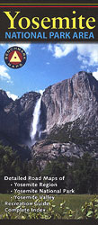
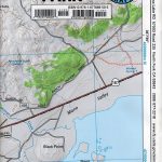
Yosemite National Park and the surrounding region from Benchmark Maps on a three-in-one indexed map providing an increasing level of detail, plus information on campgrounds and other accommodation, attractions, etc. On one side is a general road map of the region at 1:300,000 approx., centered on the Yosemite National Park, with relief shading and plenty of names of individual mountain ranges, peaks, surrounding national forests and other protected areas. Road network includes names and/or numbers of local roads and indicates seasonal closures or entry restrictions. Roads requiring high clearance or 4WD are marked. The map also highlights John Muir and Pacific Crest Trails, as well as other major hiking routes. Symbols indicate campgrounds and RV parks, and various other places of interest. The map is indexed for towns and geographical features and has latitude and longitude lines at intervals of 10’.On the reverse the national park itself is shown at 1:166,000 approx. in greater detail, with an additional enlargement at 1:35,000 approx. for the Yosemite Valley. Both maps show road access and hiking trails, visitors’ centres, campgrounds, etc. Also included are notes about the park and its attractions or facilities, with lists campgrounds and points of interest.


