Disclosure : This site contains affiliate links to products. We may receive a commission for purchases made through these links.
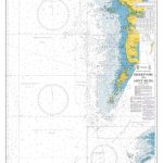
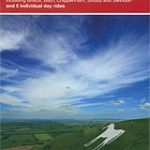
Yorkshire Wolds, York & the Humber Sustrans Cycle Map 28

Yorkshire Wolds, York & the Humber Cycle Map at 1:110,000 approx from Sustrans, including the Yorkshire Wolds Cycle Route, part of the Way of the Roses route, and Trans Pennine Trail East, plus five day rides: Hull to Hornsea Circular, Bridlington and Hunmanby Loop, York to Selby and Stamford Bridge, Malton and the High Wolds, and Beverley and the Newbalds. Street plans show York, Hull, Selby, Beverley and Bridlington.Maps is this Sustrans series show all the National and Regional Cycle Network routes clearly numbered and have the colouring distinguishing between the on-road and traffic-free sections. The publishers’ own recommendations are shown in contrasting colour and, in most titles, are additionally presented on the reverse side on separate panels where each circuit is annotated with useful notes. The maps have contours and altitude colouring to show the topography, with additional gradient markings. Towns along the routes are annotated with symbols indicating what facilities can be found there. Also marked are various places of interest, on or near the routes, and railway lines are shown with stations for access to the routes by rail. On the reverse each title also provides large, clear city centre street plans of main towns, highlighting the Cycle Network and/or the recommended routes. Also included are contact details of tourist information centres.To see the list of titles in this series please click on the series link.

Related Products:
 Lincolnshire and Wolds Sustrans Cycle Map 27
 County Durham & North Yorkshire Sustrans Cycle Map 32
 Vale of York and Yorkshire Wolds
London Sustrans Cycle Map 53
Hampshire & Isle of Wight Sustrans Cycle Map 6
Vale of York and Yorkshire Wolds
London Sustrans Cycle Map 53
Hampshire & Isle of Wight Sustrans Cycle Map 6
 Oban, Kintyre & the Trossachs 110K Sustrans Cycle Map No. 42
 Devon South Sustrans Cycle Map 2
 Aberdeenshire 110K Sustrans Cycle Map No. 45
 Great Glen & Loch Ness 110K Sustrans Cycle Map No. 47
 Kent 110K Sustrans Cycle Map No. 8
 Cairngorms & Moray Coast 110K Sustrans Cycle Map No. 46
 South West Wales 110K Sustrans Cycle Map No. 13
 West Dumfries & Galloway 110K Sustrans Cycle Map No. 36
 Lanarkshire & Scottish Borders 110K Sustrans Cycle Map No. 38
 East Midlands 110K Sustrans Cycle Map No. 21
 Shropshire, Staffordshire & The Black Country 110K Sustrans Cycle Map No. 22
 North Cumbria & Dumfries 110K Sustrans Cycle Map No. 35
 Warwickshire & South Midlands 110K Sustrans Cycle Map No. 16
 South Cambridgeshire, Bedfordshire & North Hertfordshire 110K Sustrans Cycle Map No. 17
 Ayrshire, Lanark & Isle of Arran 110K Sustrans Cycle Map No. 37
 Herefordshire, Worcestershire & North Gloucestershire 110K Sustrans Cycle Map No. 15
 Dundee, Angus & North Fife 110K Sustrans Cycle Map No. 44
North Northumberland & Scottish Borders Sustrans Cycle Map 39
Dundee, Angus & North Fife 110K Sustrans Cycle Map No. 44
North Northumberland & Scottish Borders Sustrans Cycle Map 39
 Perth, Callander & Pitlochry 110K Sustrans Cycle Map No. 43
North York Moors & Yorkshire Wolds
Perth, Callander & Pitlochry 110K Sustrans Cycle Map No. 43
North York Moors & Yorkshire Wolds
 Yorkshire Wolds Way
 Cleveland Way and Yorkshire Wolds Way
 West Yorkshire Sustrans Cycle Map 29
 Severn & Upper Thames 110K Sustrnas Cycle Map No. 11
North York Moors, Tees Valley & Durham Coast Sustrans Cycle Map 33
Severn & Upper Thames 110K Sustrnas Cycle Map No. 11
North York Moors, Tees Valley & Durham Coast Sustrans Cycle Map 33
 John O`Groats & North Scottish Coast Cycle Map
Great Britain: Sustrans/CycleCity Cycling Maps of Great Britain & Northern Ireland
John O`Groats & North Scottish Coast Cycle Map
Great Britain: Sustrans/CycleCity Cycling Maps of Great Britain & Northern Ireland
 Yorkshire Wolds Way Harvey National Trail XT40
 Kingston upon Hull – Barton-upon-Humber – Beverley A-Z Street Atlas
 Market Weighton & Yorkshire Wolds Central – Pocklington OS Explorer Map 294 (paper)
 Howardian Hills & Malton – Yorkshire Wolds North OS Explorer Map 300 (paper)
 Yorkshire Wolds (South) 1905 – 72
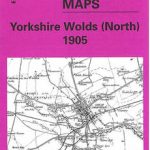 Yorkshire Wolds (North) 1905 – 64
 Market Weighton & Yorkshire Wolds Central – Pocklington OS Explorer Active Map 294 (waterproof)