Disclosure : This site contains affiliate links to products. We may receive a commission for purchases made through these links.
Yllรคs Levi
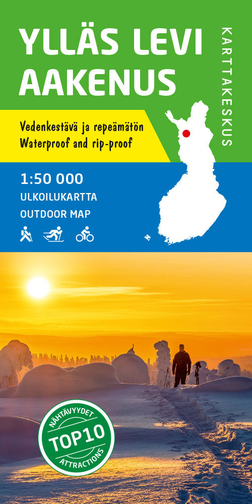
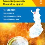
Yllรคs – Levi area at 1:50,000 on a double-sided map in a series of beautiful and informative maps covering Finland’s most popular outdoor leisure areas with cartography from Karttakeskus, the country’s topographic survey. Maps in this series have excellent use of colours, shading and symbols to provide a very detailed picture of the terrain and vegetation. Extensive overprint highlights routes for hiking, and/or other outdoor pursuits, a wide variety of accommodation, from hotels and holiday villages to Lapland tepees, food and fuel supplies, etc. The maps have a UTM grid and margin ticks for latitude and longitude. Map legends include English. IN THIS TITLE: hiking and skiing map of the Lapland fell region of popular winter resort towns and Sami villages in the north-west of Finland, close to the border with Sweden, including the towns of Sirkka, รkรคslompolo, Yllรคsjรคrvi and Kittilรค. Contours are at 5m intervals, with relief shading and colouring/symbols indicating different types of terrain and vegetation. An overprint highlights hiking trails, ski routes and canoe routes, as well as various types of accommodation (hotels, holiday camps, campsites, huts, etc.), restaurants and shopping facilities, petrol stations, etc. The map has a UTM grid and margin ticks for latitude and longitude in steps of 20`. Map legend includes English.Also provided three enlargements at 1:30,000 showing hiking and ski trails, including the illuminated routes, in the immediate environs of Sirkka, รkรคslompolo and Yllรคsjรคrvi.

Related Products:
 Lemmenjoki National Park
 Utsjoki – Kevo Nature Reserve
 Salla – Savukoski Recreational Map
 Repovesi – Mรคntyharju Karttakeskus Outdoor Map
 Helvetinjรคrvi – Seitseminen
 Evo Pรคijรคnne Ilvesvaellus
 Muotkatunturit
 Teijo
Teijo
 Kuusamo Karttakeskus Outdoor Map
 Nuuksio Luukki Karttakeskus Outdoor Map
 Hammastunturi – South Inari
 Pallas – Hetta – Olos
 Nunnanen – Kalmakaltio – Suukisjoki
 Ropi – Kalkkoaivi – Munnikurkkio
 Tuntsa – Tulppio – Sorsatunturi Karttakeskus Topo Map
Pyhรค – Luosto Karttakeskus Outdoor Map
Saariselkรค – Sokosti Karttakeskus Outdoor Map
Tuntsa – Tulppio – Sorsatunturi Karttakeskus Topo Map
Pyhรค – Luosto Karttakeskus Outdoor Map
Saariselkรค – Sokosti Karttakeskus Outdoor Map
 Sevettijรคrvi – Nuorgam
Finland: Karttakeskus Topographic Hiking Maps
Pรถyrisjรคrvi – Kalmakaltio – Hetta Karttakeskus Topo Map
Sevettijรคrvi – Nuorgam
Finland: Karttakeskus Topographic Hiking Maps
Pรถyrisjรคrvi – Kalmakaltio – Hetta Karttakeskus Topo Map
 Vuokatti – Kainuu National Park
Koli – Ruunaa – Patvinsuo – Petkeljรคrvi Karttakeskus Outdoor Map
Vuokatti – Kainuu National Park
Koli – Ruunaa – Patvinsuo – Petkeljรคrvi Karttakeskus Outdoor Map
 Catllarร s – Picancel Editorial Alpina
 Valles de Irati y Aezkoa Editorial Alpina
 Puigmal – Vall de Nuria – Ulldeter Editorial Alpina
 Cerdanya – Alta Cerdanya – Capcir – Andorra Editorial Alpina
Puigsacalm – Bellmunt Editorial Alpina
Cerdanya – Alta Cerdanya – Capcir – Andorra Editorial Alpina
Puigsacalm – Bellmunt Editorial Alpina
 Congost de Mont-rebei Editorial Alpina
 Vall de Lord – Port del Comte Editorial Alpina
 Delta of the Ebro ‘“ Serra de Montsiร Editorial Alpina
 Val d`Aran – Mauberme – Montardo – Molieres Editorial Alpina
Sant Llorenc del Munt i l`Obac Editorial Alpina
Cingles de Berti – Sant Miquel des Fai Editorial Alpina
Val d`Aran – Mauberme – Montardo – Molieres Editorial Alpina
Sant Llorenc del Munt i l`Obac Editorial Alpina
Cingles de Berti – Sant Miquel des Fai Editorial Alpina
 El Turbรณn ‘“ Alto Valle de Isรกbena Editorial Alpina
Montnegre – Corredor Editorial Alpina
El Turbรณn ‘“ Alto Valle de Isรกbena Editorial Alpina
Montnegre – Corredor Editorial Alpina
 Ripollรจs Editorial Alpina
Garraf – la Morella – Eramprunya Editorial Alpina
Ripollรจs Editorial Alpina
Garraf – la Morella – Eramprunya Editorial Alpina
 Muntanya d’Alinyร Editorial Alpina
Val d`Aran by UTMB Editorial Alpina Trail running race Map
Muntanya d’Alinyร Editorial Alpina
Val d`Aran by UTMB Editorial Alpina Trail running race Map
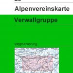 Verwallgruppe Alpenverein Map 28