Disclosure : This site contains affiliate links to products. We may receive a commission for purchases made through these links.
Yellowstone & Grand Teton NP Travel Map
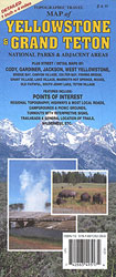
Yellowstone and Grand Teton National Parks in Wyoming on a detailed contoured road mar at 1:250,000 from GTR Mapping, with on the reverse 16 street plans of main tourist destination in the area, plus information about campgrounds and other services.On one side is a road map at 1:250,000 covering the two national parks and the adjacent areas to the east, including the Teton and Shoshone National Forests. Topography is presented by bright altitude colouring with contours at 500 feet intervals. Road information indicates gravel roads and distinguishes between tracks best suited for or passable only by 4WD vehicles. Driving distances are marked on main routes. An overprint highlights trail heads and main trails are annotated with their names. Also marked are national park and US Forest Service campgrounds, picnic areas, ski area, and various other places of interest. The map has no geographical coordinates and is not indexed. On the reverse are panels with black and white street plans of local towns and tourist resorts: Mammoth Springs, Fishing Bridge, Lake Village, Old Faithful, Bay Bridge, Canyon Village, Grant Village, Colter Bay Village, South Jenny Lake, Moose, Teton Village, Jackson, Cody, plus Gardiner in Montana. All indicate locations of various facilities.Also provided is a distance table, a list of visitor services and recreational sits, plus general notes about the area.

Related Products:
 Explorer`s Guide Yellowstone & Grand Teton National Parks and Jackson Hole – A Great Destination
 Moon Yellowstone & Grand Teton (Ninth Edition): Hike, Camp, See Wildlife
 Yellowstone & Grand Teton
 Explorer`s Guide Yellowstone & Grand Teton
 Greater Yellowstone & Grand Teton Benchnark Maps Recreation Atlas & Guide
 Lonely Planet Yellowstone & Grand Teton National Parks
 Moon Best of Yellowstone & Grand Teton (First Edition): Make the Most of One to Three Days in the Parks
 Moon Wyoming (Third Edition): With Yellowstone & Grand Teton National Parks
 Frommer`s Yellowstone and Grand Teton National Parks
 Yellowstone And Grand Teton
 Grand Teton National Park WY
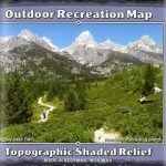
 Grand Teton NP – Jackson Hole WY Outdoor Recreation Map
 Teton Range – Core Trails WY Outdoor Recreation Map
 Costa Rica Travel Map
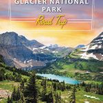 Moon Yellowstone to Glacier National Park Road Trip (First Edition): Jackson Hole, the Grand Tetons & the Rocky Mountain Front
 Western & Northern Canada ITMB Travel Atlas
 Alberta & Saskatchewan
 Saskatchewan MapArt
 Saskatchewan FastTrack
 Laos Periplus Travel Map
 Golden Triangle Road Map – Delhi – Agra – Jaipur
 Yellowstone Lake – Yellowstone National Park WY
 Sri Lanka Periplus Travel Map
 Bali & Lombok ITMB
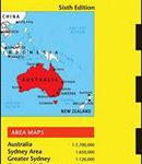 Australia Periplus Travel Map
 Lofoten and Vesteralen Islands
 Kecskemรฉt (with Kiskunsรกg National Park)
 Bulgaria – City Centres Domino Road Map
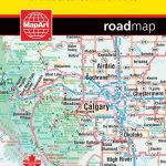 Alberta MapArt
 New Zealand Kiwimaps Travel & Touring Map
 Bulgaria (with Street Plans of Black Sea Resorts)
 Sumatra – Medan Periplus Travel Map
 Lisburn City OSNI Street Plan
 China Periplus Travel Map
 USA: Great Pacific Recreation & Travel Maps of the Pacific Northwest
 Singapore Periplus Travel Map
 Manitoba & Saskatchewan
 Armagh City OSNI Street Plan
 New Zealand / Aotearoa Hema
Palermo TCI Street Plan
New Zealand / Aotearoa Hema
Palermo TCI Street Plan