Disclosure : This site contains affiliate links to products. We may receive a commission for purchases made through these links.
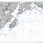
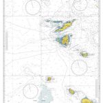
Y50 Saint Mary`s, Tresco and Surrounding Islands

First edition. Part of the small format Y series (A2 size), this replicates sheet 2400.15 from the 2400 West Country Chart Pack

Related Products:
 Imray Chart: Saint Marys, Tresco and Surrounding Islands 2400.14
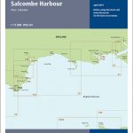 Y44 Salcombe
 Y46 River Fowey
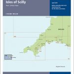 Y49 Isles of Scilly
 Y43 River Dart
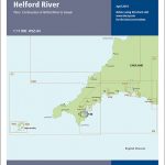 Y48 Helford River
 Y47 Falmouth Harbour
 Y45 Plymouth Harbour
 Admiralty Chart SC5603_11 – Isles of Scilly Saint Mary`s Pool to Tresco
 Admiralty Chart 883 – Saint Mary`s and the Principal Off-Islands
 2400 West Country Chart Pack – 2019 edition
 Admiralty Chart SC5603_10 – Isles of Scilly Saint Agnes to Saint Mary`s Pool
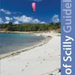 Isles of Scilly Guidebook: St Mary`s, St Agnes, Bryher, Tresco, St Martin`s
 Admiralty Chart 160 – Saint Abb`s Head to the Farne Islands
 SHOM Chart 7076L – De Saint-Nazaire ร Saint-Malo – Leisure A4 size
 Admiralty Chart 4976 – Cape Saint Elias to Shumagin Islands
 Admiralty Chart 4714 – Cocos (Keeling) Islands to Ile Saint-Paul
 Val-Suzon – Saint-Etienne-l`Abbaye – Dijon West IGN 3022ET
 Admiralty Chart 3281 – Shetland Islands North-West Sheet
 Saint-Jean-Pied-de-Port – Saint-Etienne-de-Baigorry – Vallee des Aldudes IGN 1346OT
New Zealand Charts for South Island, Surrounding Islands and Antarctic Territories
SHOM Chart 7076 – De Saint-Nazaire ร Saint-Malo
Saint-Jean-Pied-de-Port – Saint-Etienne-de-Baigorry – Vallee des Aldudes IGN 1346OT
New Zealand Charts for South Island, Surrounding Islands and Antarctic Territories
SHOM Chart 7076 – De Saint-Nazaire ร Saint-Malo
 SHOM Chart 7626 – Saint Christopher (Saint Kitts), Sint Eustatius et Saba
 NOAA Chart 530 – North America West Coast’”San Diego to Aleutian Islands and Hawai’ian Islands
 SHOM Chart 7472 – Ports et mouillages de Saint-Martin (Sint Maarten) et de Saint-Barthรฉlemy
 Admiralty Chart 2524 – Islands off the North West Coast of Scotland
 Mary and Frankenstein: The True Story of Mary Shelley
 Admiralty Chart 583 – Sombrero Island to Saint Christopher (Saint Kitts)
 Admiralty Chart 487 – Saint Christopher (Saint Kitts)- Sint Eustatius and Saba
 Admiralty Chart 197 – North West Approaches to Saint Lucia
 Imray UK small-format charts: 2400 series: The West Country
 Saint-Jean-de-Maurienne – Saint-Francois-Longchamp – Valmorel IGN 3433ET
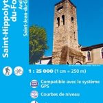 Saint-Hippolyte-du-Fort – Anduze – Saint-Jean-du-Gard IGN 2741ET
 Saint-Benin-d`Azy – Saint-Saulge IGN 25K Sรฉrie Bleue Map 2624SB
 Ganges – Saint-Martin-de-Londres – Pic Saint-Loup IGN 2742ET
 Saint-Chely-d`Apcher – Saint-Amams IGN 2637SB
 Admiralty Chart 2079 – Ports and Anchorages in Anguilla-Sint Maarten (Saint Martin) and Saint Barthelemy
 NGA Chart 81145 – Palau Islands Northern Part [West Caroline Islands]
 SHOM Chart 6967L – De Saint Agnes Head ร Dodman Point – Isles of Scilly – Leisure A4 size
 Cape Town & Surrounding Attractions Map Studio