Disclosure : This site contains affiliate links to products. We may receive a commission for purchases made through these links.
Y40 River Exe – Laminated chart
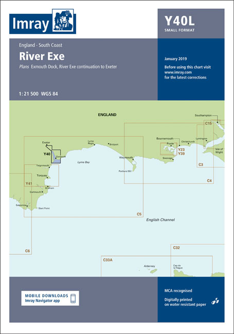
Laminated chart Y40Plans included:Exmouth Dock (1:7500)River Exe continuation to Exeter (1:21 500)
Related Products:
 Admiralty Chart SC5602_20 – Helford River – Helford River Continuation to Gweek – Continuation of River Fal. (Ruan Creek)
 Admiralty Chart SC5602_3 – River Fal Saint Just Pool to Truro River – Continuations of Truro River, Tresillian River and Carnon River
 Y41 Teignmouth and Tor Bay – Laminated chart
 Admiralty Chart SC5600_6 – Beaulieu River – Continuation of Beaulieu River – Isle of Wight, Newton River and Continuation
 Admiralty Chart SC5600_22 – River Medina – Continuation of River Medina – River Medina, Folly Point to Newport
 Admiralty Chart SC5600_4 – Lymington River – Continuation of Lymington River – Isle of Wight Yarmouth Harbour, River Yar
 2300 Dorset and Devon Coasts Chart Pack – 2019 edition
 Admiralty Chart SC5602_7 – Fowey Harbour – River Fowey Mixtow to Saint Winnow – Continuation of River Fowey Saint Winnow to Lostwithiel
 Imray Chart C2: The River Thames
 Admiralty Chart SC5600_9 – River Hamble to Cowes – Continuation to Hythe
 Admiralty Chart SC5607_13 – Continuation of River Crouch – Burnham-on-Crouch – Entrance to Walton Backwaters – Continuation to Battlesbridge
 Admiralty Chart SC5607_6 – Approaches to Harwich and Woodbridge Haven – Continuation of River Deben
 Admiralty Chart SC5615_17 – River Forth Grangemouth Roads – River Forth, Grangemouth and River Carron – River Forth River Carron
 Admiralty Chart SC5607_12 – Rivers Crouch and Roach – Continuation of the River Roach
 NOAA Chart 18581 – Yaquina Bay and River – Continuation of Yaquina River
 Admiralty Chart SC5623_16 – Courtmacsherry Bay – Continuation of Argideen River
 Admiralty Chart 3275 – Milford Haven Milford Dock to Picton Point
 Y39 Poole Harbour – Laminated
 Y36 Central Solent – Laminated Chart
 Admiralty Chart 2290 – River Exe and Approaches Including Exeter Canal
 Imray Chart: Laminated Isles of Scilly 2400.3
 2400 West Country Chart Pack – 2019 edition
 Admiralty Chart SC5602_18 – Upper Reaches of River Dart, River Yealm and Looe
 Admiralty Chart SC5622_12 – Upper Harbour West – Continuation of River Lee to Cork
 Admiralty Chart SC5622_4 – Passage East to Beacon Quay and Pink Point – Continuation of River Barrow to New Ross – Continuation of Queen`s Channel to Waterford – New Ross
 CHS Chart 6438 – Peel River, Mackenzie River to Road Island
 Y46 River Fowey
 NOAA Chart 16662 – Cook Inlet’”Kalgin Island to North Foreland – Drift River – Kasilof River to Kenai River – Nikiski
 Y43 River Dart
 Y48 Helford River
 Admiralty Chart SC5615_21 – River Tyne Royal Quays to Willington Quay – River Tyne Willington Quay to Wincomblee – River Tyne Wincomblee to Newcastle Upon Tyne
 NOAA Chart 18661 – Sacramento and San Joaquin Rivers – Old River, Middle River and San Joaquin River extension – Sherman Island
 SHOM Chart 7789 – De Pennington River ร Opobo River
 Admiralty Chart SC5612_23 – Lough Foyle – River Foyle, Culmore Point to Ballynagard – River Foyle, Ballynagard to Londonderry
 Exe Estuary Walking & Cycling Map 39 – Exeter to Dawlish Warren & Exmouth Including Topsham
 NOAA Chart 12311 – Delaware River’”Smyrna River to Wilmington
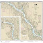 NOAA Chart 12377 – Connecticut River’”Deep River to Bodkin Rock
 Y18 The River Medway and Approaches
 NOAA Chart 14853 – SMALL-CRAFT BOOK CHART – Detroit River, Lake St. Clair and St. Clair River (book of 47 charts)
 C29 Harwich to Whitby


