Disclosure : This site contains affiliate links to products. We may receive a commission for purchases made through these links.
Wroclaw with Historical Place Names
Wroclaw on a street plan showing both current and old, pre-WWII German street and district names and no longer existing streets, with an enlargement for the town centre. Coverage extends from Muchobรณr and Krzyki to Sepolno and Psie Pole.Tram routes are shown with stops and line numbers. Main public buildings are identified and symbols mark locations of post offices, police stations, campsites, etc. An enlargement shows the town centre in greater detail. Both plans show current and old pre-WWII German names of streets, districts, etc., and indicate no longer existing streets. Map legend includes English.On the reverse the index has two lists: current and old names, cross-referenced. Also included are extensive notes on the city’s main sites, in German only.

Related Products:
 Stettin / Szczecin
 Wroclaw ExpressMap Street Plan
 Wroclaw and Environs pre and post 1945
 Poland/Czech Republic: Hรถfer 200K Road Maps with Historical Place Names
 Ruse
Ruse
 France: IGN Street Plans
 Irkutsk
 Galway OSI Street Map
 Adana Main Roads Map
 Arkhangelsk
 Arad – Timisoara Cartographia Street Plan
 Omsk
Omsk
 Northland: Whangarei, Bay of Islands and 61 Provincial Towns Pathfinder
 Baghdad
 Riga and Vicinity Jana Seta Street Atlas
 Zurich Pocket Plan
 Christchurch Visitors` Street Plan
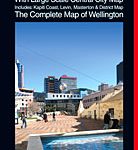 Wellington Complete Metromap
 Dunedin, Mosgiel, Oamaru and Otago Towns Pocket Map
 Lille and Surroundings Blay-Foldex Street Atlas
 France: Blay-Foldex Street Plans
 New Plymouth and Taranaki Towns Pocket Map
 Milan Red Maps
 Yangon: Historical Walks Map
 Vilnius Jana Seta Street Plan WATERPROOF
 Novosibirsk
 Katowice ExpressMap Street Plan
 Santiago de Chile Trekkingchile Street Plan
 Lisbon Borch
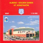 Varna
Varna
 Lublin – Swidnik ExpressMap Street Plan
Wroclaw Environs – Lower Silesia ExpressMap Tourist Map
Kielce ExpressMap Street Plan
Versailles
Silesia
Lublin – Swidnik ExpressMap Street Plan
Wroclaw Environs – Lower Silesia ExpressMap Tourist Map
Kielce ExpressMap Street Plan
Versailles
Silesia
 Cesky Krumlov and Prachatice Street Plans
 Reims IGN Street Map
 Avignon IGN Street Map
 Amsterdam Red Maps