Disclosure : This site contains affiliate links to products. We may receive a commission for purchases made through these links.
World War I Battlefields: Amiens – Albert – Bapaume
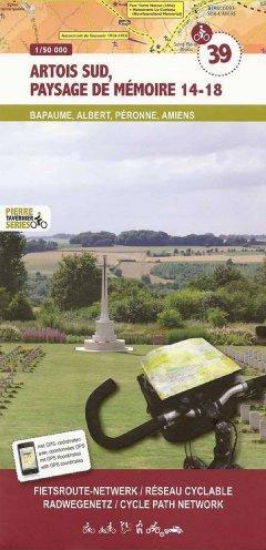
World War I Battlefields: Amiens – Albert – Bapaume area in a series of cycling maps from Sportoena covering Belgium and the adjoining regions of the neighbouring countries, with local routes, long-distance cycling paths, classification according to the density of traffic, campsites and places of interest, etc.Brightly coloured base and the presentation of the road network differ greatly from what one usually sees on maps at this scale and may not appeal to all map users, but are designed to provide a clear picture not only of the recommended cycling routes but also of the alternatives along other roads.Colour coding of the routes looks at the first glance somewhat complicated but on closer inspection it does provide a very detailed classification, highlighting the recommended paths whilst at the same time indicating the density of motorized traffic on them. The maps also show routes along rivers or disused railway lines, and where cycling networks have been set up the routes with their orientation post numbers. Long-distance cycling routes are prominently marked.All other roads shown on the maps, from motorways to country lanes, are also classified according to the density of motorized traffic. The maps also show selected hiking paths and railway lines with stations. A range of symbols highlight various facilities and places of interest, including campsites and holiday villages, nature reserves, viewpoints, war cemeteries and other memorials or monuments, etc.Topography is meant to be indicated by the colouring of the base, but the gradation of the colours is too fine to provide any effective information. Wooded and heath areas are marked. Most titles are double-sided. The maps have no index or geographical coordinates.Map legend includes English.


