Disclosure : This site contains affiliate links to products. We may receive a commission for purchases made through these links.
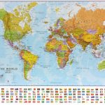
World Schofield & Sims Political Wall Map
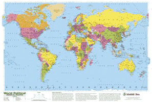
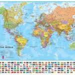
Glossy political map of the world (77 x 53cm / 30 x 21″ approx.) from Schofield & Sims, in bright colours, printed on thin, good quality card. Its Modified Gall projection is a compromise between traditional presentations and the equal area Peters projection.Countries are shown in bright colours against vivid blue oceans. All place names are given in their English versions. There is no shading to show mountainous areas, etc, but main geographical features (the Sahara, Kirghiz Steppe, the Andes, etc) as indicated. In larger countries: Canada, USA, Brazil and Australia, internal the division into provinces/states is also shown. Latitude and longitude lines are drawn at intervals of 15ยฐ, with clocks along the longitude lines indicating the difference from the GMT (i.e. not the actual time zones).Projection in Modified Gall, with additional notes about it placed under the map.

Related Products:
 World Maps International Political Wall Map SMALL PAPER
 United Kingdom & Ireland Schofield & Sims Wall Map
 World Maps International Political Wall Map LARGE PAPER
 World Maps International Political Wall Map MEDIUM PAPER
 World: Michelin Political Wall Maps
 World Maps International Political Wall Map SMALL PIN-BOARD FRAMED with flags
 World Maps International Political UPSIDE-DOWN Wall Map LARGE PAPER
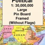
 World Maps International Political Wall Map LARGE PIN-BOARD FRAMED with flags
 World Maps International Political Wall Map SMALL MAGNETIC-BOARD FRAMED with flags
 World Maps International Political Wall Map MEDIUM PIN-BOARD FRAMED with flags
 World Political F&B
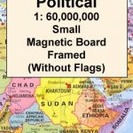
 World Maps International Political Wall Map MEDIUM MAGNETIC-BOARD FRAMED with flags
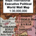 World Maps International Executive Political Wall Map
 World Maps International Political Wall Map LARGE MAGNETIC-BOARD FRAMED with flags
 World K+F Political 30M Wall Map LAMINATED
 World Maps International Political Wall Map SMALL HANGING-STRIPS (with flags)
 World Maps International Political Wall Map SMALL MAGNETIC-BOARD FRAMED without flags
 World Maps International Political Wall Map SMALL PIN-BOARD FRAMED without flags
 World Maps International Political Wall Map LARGE MAGNETIC-BOARD FRAMED without flags
 World Maps International Political Wall Map LARGE HANGING-STRIPS (with flags)
 World F&B Political Wall Map MEDIUM
 World Maps International Political Wall Map MEDIUM LAMINATED
 World Maps International Political Wall Map MEDIUM MAGNETIC-BOARD FRAMED without flags
 World K+F Political 30M Wall Map MEDIUM PIN-BOARD
 World Maps International Political Wall Map MEDIUM HANGING STRIPS (with flags)
 World Maps International Political Wall Map LARGE PIN-BOARD FRAMED without flags
 World Maps International Political Wall Map X-LARGE PAPER
 World Maps International Political Wall Map MEDIUM PIN-BOARD FRAMED without flags
World: Kรผmmerly + Frey Political Wall Maps
World Maps International Political Wall Map MEDIUM PIN-BOARD FRAMED without flags
World: Kรผmmerly + Frey Political Wall Maps
 World Maps International Political Wall Map SMALL ENCAPSULATED
 World Maps International Political Wall Map LARGE ENCAPSULATED
 World & Flags Hema Political Pacific-Centred
 World Maps International Political Wall Map X-LARGE MAGNETIC-BOARD FRAMED
 World Maps International Political Wall Map X-LARGE PIN-BOARD FRAMED
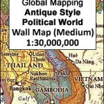 World Global Mapping Antique Political Wall Map LARGE PAPER
 World F&B Political Wall Map MEDIUM – with Metal Hanging Strips
 World F&B Political Wall Map LARGE
 World Maps International Political Wall Map SMALL HANGING-STRIPS (without flags)
 World K+F Political 30M Map
 World Maps International Political Wall Map LARGE HANGING-STRIPS (without flags)