Disclosure : This site contains affiliate links to products. We may receive a commission for purchases made through these links.
World Physical – Sea Relief F&B
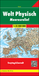
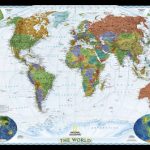
Folded map of the world from Freytag & Berndt with very effective relief shading to make mountain chains stand out on the land masses, plus shading and colouring on the seas to indicate main trenches and ridges of the sea floor.Land masses have colouring to show different types of vegetation or the terrain: tropical rain forest, broadleaf and conifer forest, steppe, deserts, tundra, and glaciers. Relief shading very effectively shows mountain ranges, and the maps also has graphics for salt lakes and swaps. National boundaries and capitals are marked. On sea shading and colouring indicates sea floor ridges, although not as finely and with as many names as on similar National Geographic maps. Two insets present the Antarctic and the Arctic. Place names of countries, cities and other features are in English. Latitude and longitude are drawn at 10ยฐ intervals. Map legend includes English.

Related Products:
 World F&B Physical – Sea Relief Wall Map
 World Political/Physical – Sea Relief F&B Wall Map LAMINATED with Metal Hanging Strips
 World NGS Physical / Ocean Floor Wall Map ENCAPSULATED
 World NGS Physical / Ocean Floor Wall Map LARGE PAPER
 World NGS Physical / Ocean Floor Wall Map LARGE ENCAPSULATED
 World NGS Physical Wall Map POSTER-SIZE PAPER
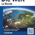
 World: Freytag & Berndt Political/Physical World Wall Maps
 World Political – Sea Relief F&B Wall Map LAMINATED
 World F&B Political – Sea Relief Wall Map XXL LAMINATED
 World NGS Physical Wall Map POSTER-SIZE ENCAPSULATED
 World NGS Explorer Executive Wall Map PAPER
 World NGS Explorer Executive Wall Map ENCAPSULATED
 World K+F Physical 20M Wall Map LAMINATED
 Colour The World F&B Wall Map
 World K+F Physical 30M Wall Map LAMINATED
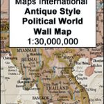 World Maps International Antique Political Wall Map
 Colour The World F&B Wall Map – with Metal Hanging Strips
 World K+F Physical 30M Map
 World NGS Executive Wall Map PAPER
 World: National Geographic Society Executive Style Political Wall Maps
 World: National Geographic Society Decorator Style Political Wall Maps
 World NGS Executive Wall Map LARGE PAPER
 World NGS Executive Pacific-Centered Wall Map PAPER
 NGS Executive Political World Wall Map FRAMED
 World NGS Executive Pacific-Centered Wall Map LARGE PAPER
 NGS Executive Political World Wall Map ENLARGED, FRAMED
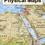 World: Maps International Physical Wall Maps
 World NGS Executive Mural Wall Map 3-SHEET SET PAPER
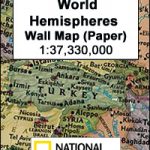 World Hemispheres NGS Wall Map PAPER
 World Maps International Physical Wall Map LARGE PAPER
 World Maps International Physical Wall Map X-LARGE PAPER
 World 3 Global Views Raven Maps Physical Wall Map
 World NGS Decorator Wall Map PAPER
 World IGN Physical 14M Wall Map PLASTIC 3-Sheet Set
 World: Global Mapping Antique Style Political Wall Maps
 World NGS Decorator Wall Map LARGE PAPER
 Freytag & Berndt World Physical – Sea Relief Wall Map LARGE
 World Maps International Physical Wall Map LARGE HANGING-STRIPS
 World NGS Executive Wall Map ENCAPSULATED
 World Maps International Physical Wall Map X-LARGE ENCAPSULATED