Disclosure : This site contains affiliate links to products. We may receive a commission for purchases made through these links.
World NGS Decorator Wall Map PAPER
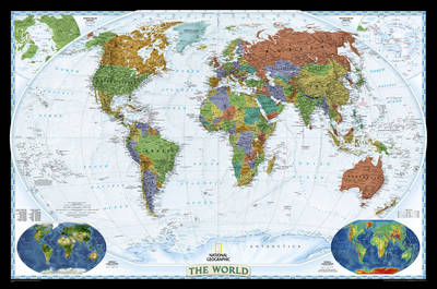
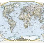
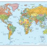
NGS Decorator Political World Map, standard size 116 x 75.5cm (45.5″ x 29.5″ approx) ‘“ paper version, a colourful political map of the world with pale blue oceans pleasantly contrasting with the darker shades used for countries, plus additional insets showing vegetation and physical geography. Relief shading used for mountain chains on land masses is very effectively extended to the floor of the oceans, showing continental shelves and numerous ridges, many with names. Elevation for mountain peaks is given in feet. Within USA, Canada and Australia internal administrative boundaries and names of states/provinces are shown. The two Polar Regions are presented as insets in the top corners, while at the bottom two colourful maps of the world show vegetation cover and landforms (physical geography). Clocks show time difference from GMT (but without the map indicating the exact geographical area covered by each time zone). The map also includes a list of 10 largest countries by area and by populations. Projection is Winkel Tripel, which reduces distortion of land masses as they near the poles.To see the encapsulated version of this map and the enlarged sizes please click on the series link.

Related Products:
 World NGS Decorator Wall Map LARGE PAPER
 World: National Geographic Society Decorator Style Political Wall Maps
 World NGS Decorator Wall Map ENCAPSULATED
 World NGS Decorator Wall Map LARGE ENCAPSULATED
 The World – The National Geographic 125th Anniversary Wall Map PAPER
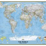
 World NGS Classic Wall Map PAPER
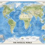 World NGS Physical Wall Map POSTER-SIZE PAPER
 World NGS Classic Wall Map POSTER-SIZE PAPER
 World NGS Executive Wall Map LARGE PAPER
 World NGS Classic Wall Map LARGE PAPER
 World NGS Physical / Ocean Floor Wall Map LARGE PAPER
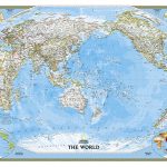
 World NGS Executive Pacific-Centered Wall Map PAPER
 World NGS Executive Wall Map PAPER
 World NGS Classic Pacific-Centered Wall Map LARGE PAPER
 World NGS Executive Mural Wall Map 3-SHEET SET PAPER
 World NGS Classic Mural Wall Map 3-SHEET SET PAPER
 World NGS Executive Pacific-Centered Wall Map LARGE PAPER
 World NGS Physical / Ocean Floor Wall Map ENCAPSULATED
 World NGS Explorer Wall Map PAPER
 World Global Mapping Antique Political Wall Map LARGE PAPER
 World NGS Explorer Executive Wall Map PAPER
 World Global Mapping Political Wall Map LARGE PAPER
 World NGS Physical / Ocean Floor Wall Map LARGE ENCAPSULATED
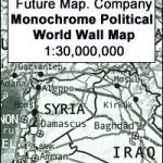 Future Mapping Company Monochrome Political World Wall Map PAPER
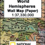 World Hemispheres NGS Wall Map PAPER
 World Michelin Wall Map PAPER
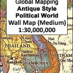
World Global Mapping Political Wall Map MEDIUM PAPER
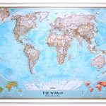
NGS Executive Political World Wall Map FRAMED
World Michelin Wall Map PAPER
World Global Mapping Political Wall Map MEDIUM PAPER
NGS Executive Political World Wall Map FRAMED
 NGS Executive Political World Wall Map ENLARGED, FRAMED
 World Political – Sea Relief F&B Wall Map LAMINATED
 World K+F Physical 20M Wall Map LAMINATED
 World K+F Physical 30M Wall Map LAMINATED
 World NGS Classic Wall Map STANDARD SIZE, PIN BOARD, FRAMED
 World Rand McNally Signature Wall Map PAPER
 World Rand McNally Classic Wall Map PAPER
 World IGN Physical 14M Wall Map PLASTIC 3-Sheet Set
 World Political/Physical – Sea Relief F&B Wall Map LAMINATED with Metal Hanging Strips
 NGS Classic Political World Wall Map ENLARGED, PIN BOARD, FRAMED
 Colour The World F&B Wall Map
 World Maps International Physical Wall Map LARGE PAPER