Disclosure : This site contains affiliate links to products. We may receive a commission for purchases made through these links.
World Michelin Wall Map PAPER
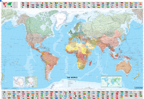
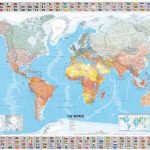
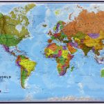
Political map of the world from Michelin, 144 x 100cm (4’7″ x 3’3″ approx.), with pleasant subdued colours of different countries contrasted against light blue oceans, and presented with panels of country flags above and below the map.Country names are in large, clearly legible print. English versions of names are used throughout. Within some larger countries such as USA, Canada and Brazil or Australia internal state or provincial boundaries are indicated. Central Pacific, from Alaska/Siberia to New Zealand, is repeated on both sides of the map for better presentation of that region.The map has well drawn relief shading to show the mountainous areas like the Rockies or the Andes, enhancing the overall presentation. The colouring of the oceans shows different depths and the extent of the polar ice cap is indicated. Projection is Van der Grinten. Two insets show Antarctica and the Arctic, both annotated with dates of various exploratory expeditions. Also provided is a panel indicating time zones. * The map is also available encapsulated, or framed and mounted either on a magnetic board or on a pin board.

Related Products:
 World Michelin Wall Map PIN-BOARD FRAMED
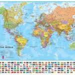
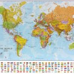
World: Michelin Political Wall Maps
World Michelin Wall Map MAGNETIC-BOARD FRAMED
World Michelin Wall Map PIN-BOARD FRAMED
World: Michelin Political Wall Maps
World Michelin Wall Map MAGNETIC-BOARD FRAMED
 World Maps International Political Wall Map SMALL PAPER
 World Michelin Wall Map ENCAPSULATED
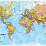
 World Maps International Political Wall Map LARGE PAPER
 World Maps International Political Wall Map MEDIUM PAPER
 World Maps International Political Wall Map X-LARGE PAPER
 World Maps International Political Wall Map SMALL PIN-BOARD FRAMED with flags
 World Maps International Political Wall Map LARGE PIN-BOARD FRAMED with flags
 World Maps International Political Wall Map MEDIUM PIN-BOARD FRAMED with flags
 World Maps International Political Wall Map X-LARGE PIN-BOARD FRAMED
 World Maps International Political Wall Map LARGE MAGNETIC-BOARD FRAMED with flags
 World Maps International Political Wall Map SMALL MAGNETIC-BOARD FRAMED with flags
 World Maps International Political Wall Map MEDIUM MAGNETIC-BOARD FRAMED with flags
 World Maps International Political Wall Map SMALL PIN-BOARD FRAMED without flags
 World Maps International Political Wall Map LARGE PIN-BOARD FRAMED without flags
 World Maps International Political Wall Map MEDIUM PIN-BOARD FRAMED without flags
 World Maps International Political Wall Map X-LARGE MAGNETIC-BOARD FRAMED
 World Maps International Political Wall Map SMALL MAGNETIC-BOARD FRAMED without flags
 World Maps International Political Wall Map LARGE MAGNETIC-BOARD FRAMED without flags
 World Maps International Political Wall Map MEDIUM MAGNETIC-BOARD FRAMED without flags
 World Maps International Political Wall Map SMALL HANGING-STRIPS (with flags)
 World Maps International Political Wall Map LARGE HANGING-STRIPS (with flags)
 World Maps International Political Wall Map MEDIUM HANGING STRIPS (with flags)
 World Maps International Political Wall Map MEDIUM LAMINATED
 World Maps International Political Wall Map SMALL ENCAPSULATED
 World Maps International Political Wall Map LARGE ENCAPSULATED
 Australasia Political Wall Map: PAPER
 Europe Maps International Political Wall Map PAPER LARGE
 World Maps International Political Wall Map SMALL HANGING-STRIPS (without flags)
 Europe Maps International Political Wall Map X-LARGE PAPER
 World Maps International Political Wall Map LARGE HANGING-STRIPS (without flags)
 Asia Maps International Political Wall Map PAPER
 World Maps International Political Wall Map MEDIUM HANGING-STRIPS (without flags)
 World Maps International Political Wall Map X-LARGE LAMINATED
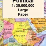
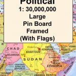
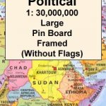
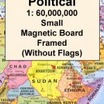
 Africa Maps International Political Wall Map PAPER
World: Maps International Political Wall Maps
Africa Maps International Political Wall Map PAPER
World: Maps International Political Wall Maps
 South America Maps International Political Wall Map PAPER
 North America: Maps International Political Wall Map PAPER