Disclosure : This site contains affiliate links to products. We may receive a commission for purchases made through these links.
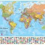
World Maps International Political Wall Map X-LARGE MAGNETIC-BOARD FRAMED
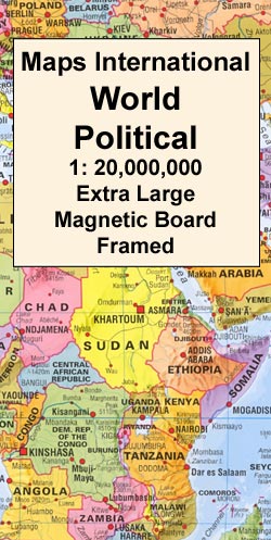
Framed, 198 x 122cm (6ft 6’’ x 4ft approx.) version of the extra large political map of the world from Maps International mounted on *magnetic board* to which magnetic makers can be attached. Countries are shown in bright vivid colours against light blue oceans. Country names are in large, clearly legible print. English versions of all city names are used throughout. Within USA, Canada and Brazil internal state or provincial boundaries are indicated. Central Pacific, from Alaska/Siberia to New Zealand, is repeated on both sides of the map for better presentation of that region.The map has well designed relief shading to show the mountainous areas like the Rockies or the Andes, enhancing the overall presentation. The colouring of the oceans also shows different depths. Projection is Van der Grinten.Clocks show time difference from GMT (but without the map indicating the exact geographical area covered by each time zone). Unlike the three smaller sizes of this map, this extra large version comes without the panel of flags, but includes part of the coast of the Antarctic.* This 1:20,000,000 map is also available on paper, encapsulated, or framed on pin board. The same design is also available is three smaller sizes – please click on the link above to see the full list of currently available titles.*Magnetic Markers: please enter `magnetic markers` in the search box above to see our range of colours.*These magnetic board maps are produced on demand.Please get in touch with us for more information.

Related Products:
 World Maps International Political Wall Map LARGE MAGNETIC-BOARD FRAMED without flags
 World Maps International Political Wall Map LARGE MAGNETIC-BOARD FRAMED with flags
 World Maps International Political Wall Map MEDIUM MAGNETIC-BOARD FRAMED with flags
 World Maps International Political Wall Map MEDIUM MAGNETIC-BOARD FRAMED without flags
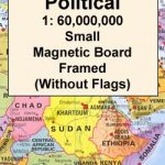 World Maps International Political Wall Map SMALL MAGNETIC-BOARD FRAMED without flags
 World Maps International Political Wall Map SMALL MAGNETIC-BOARD FRAMED with flags
 World Maps International Political Wall Map X-LARGE PIN-BOARD FRAMED
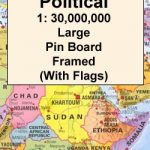 World Maps International Political Wall Map LARGE PIN-BOARD FRAMED with flags
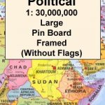 World Maps International Political Wall Map LARGE PIN-BOARD FRAMED without flags
 World Maps International Political Wall Map MEDIUM PIN-BOARD FRAMED with flags
 World Maps International Political Wall Map MEDIUM PIN-BOARD FRAMED without flags
 World Maps International Political Wall Map SMALL PIN-BOARD FRAMED without flags
 World Maps International Political Wall Map SMALL PIN-BOARD FRAMED with flags
 World Michelin Wall Map MAGNETIC-BOARD FRAMED
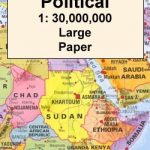
 World Maps International Political Wall Map X-LARGE PAPER
 World Maps International Political Wall Map X-LARGE LAMINATED
 World Maps International Political Wall Map LARGE PAPER
 World Maps International Political Wall Map LARGE HANGING-STRIPS (without flags)
 World Maps International Political Wall Map LARGE ENCAPSULATED
 World Maps International Political Wall Map LARGE HANGING-STRIPS (with flags)
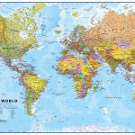
World: Maps International Political Wall Maps
World Maps International Political Wall Map LARGE HANGING-STRIPS (with flags)
World: Maps International Political Wall Maps
 World Maps International Political Wall Map MEDIUM PAPER
World Michelin Wall Map PIN-BOARD FRAMED
World Maps International Political Wall Map MEDIUM PAPER
World Michelin Wall Map PIN-BOARD FRAMED
 World Maps International Political Wall Map SMALL PAPER
 World Maps International Political Wall Map MEDIUM LAMINATED
 World Maps International Political Wall Map MEDIUM HANGING-STRIPS (without flags)
 World Maps International Political Wall Map MEDIUM HANGING STRIPS (with flags)
 World Maps International Political Wall Map SMALL HANGING-STRIPS (without flags)
 World Maps International Political Wall Map SMALL HANGING-STRIPS (with flags)
 World Maps International Political Wall Map SMALL ENCAPSULATED
 NGS Classic Political World Wall Map ENLARGED, PIN BOARD, FRAMED
 World K+F Physical 30M Wall Map MEDIUM MAGNETIC-BOARD
 Europe Maps International Political Wall Map X-LARGE PAPER
World: Kรผmmerly + Frey Political Wall Maps
Europe Maps International Political Wall Map X-LARGE PAPER
World: Kรผmmerly + Frey Political Wall Maps
 Europe: Maps International Political Wall Maps
 Europe Maps International Political Wall Map PAPER LARGE
 World Maps International Political UPSIDE-DOWN Wall Map LARGE PAPER
 Europe: Maps International Political Wall Map LARGE, HANGING STRIPS
 Asia: Maps International Political Wall Maps
 Australasia: Maps International Political Wall Maps