Disclosure : This site contains affiliate links to products. We may receive a commission for purchases made through these links.
World Maps International Physical Wall Map X-LARGE ENCAPSULATED
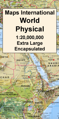
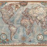
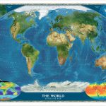
Encapsulated, extra large (198.5 x 123.5cm / 6ft 6’’ x 4ft approx.), impressive and informative physical map of the world which very successfully combines physical relief with vegetation or terrain colouring and well displayed names of countries and their boundaries. Excellent relief shading presents the mountainous areas in almost 3-D effect. Peak symbols help to identify the highest mountain on each continent or in various countries. 18 different combinations of colouring and graphics show various types of vegetation and terrain: tundra and glaciers or ice caps; coniferous, mixed or rain forests; savannah, grassland or steppe; sand or rocky deserts, lava fields and salt lakes, arable land, etc.Country names and their boundaries are clearly displayed, with town symbols indicating national and, where possible, state or provincial capitals. Within USA, Canada, Brazil and Australia state or provincial boundaries are also shown. On oceans, in addition to different shades of colouring, numerous depth figures are provided. Central Pacific, from Siberia/Alaska to New Zealand, is repeated on both sides of the map for better presentation of that region. Clocks indicate time difference from GMT (but without the maps showing the exact geographical area covered by each time zone). Projection is Van der Grinten.* This map is also available in a smaller size (136 x 85cm / 4ft 5’’ x 2ft 10″ approx.), on paper, encapsulated or with hanging strips – please click on the link above to see the full list of currently available titles. *LAMINATED and ENCAPSULATED WALL MAPS:*- *laminated* wall maps have a thin layer of plastic usually applied to the printed side only. They can be written on with suitable marker pens without any damage to the map but, unless laminated on both sides, they are not damp-proof.- *encapsulated* wall maps are sealed between two sheets of plastic. They are more rigid and heavier than laminated maps of the same size. They are damp-proof and do not crinkle in humid conditions. Encapsulation gives the map a shiny surface, similar to being displayed behind glass.- *please note:* many publishers and retailers often use these two terms interchangeably. Our map titles and descriptions follow the definitions provided above.

Related Products:
 World Maps International Physical Wall Map LARGE LAMINATED
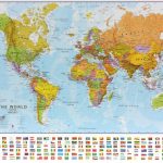
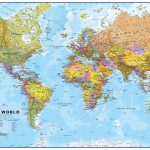
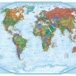
 World Maps International Political Wall Map LARGE ENCAPSULATED
 World Maps International Political Upside-down Wall Map LARGE ENCAPSULATED
 Europe Maps International Political Wall Map LARGE ENCAPSULATED
 Europe Maps International Political Wall Map X-LARGE ENCAPSULATED
 World Maps International Physical Wall Map LARGE HANGING-STRIPS
 World Maps International Political Wall Map SMALL ENCAPSULATED
 World Maps International Political Upside-down Wall Map LARGE HANGING-STRIPS
 World Maps International Political Wall Map X-LARGE LAMINATED
 Asia Maps International Political Wall Map ENCAPSULATED
 Africa Maps International Political Wall Map ENCAPSULATED
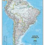
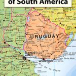 South America Maps International Political Wall Map ENCAPSULATED
 World Maps International Physical Wall Map LARGE PAPER
 World Maps International Physical Wall Map X-LARGE PAPER
 World Maps International Political Wall Map MEDIUM LAMINATED
 USA Michelin Physical Wall Map ENCAPSULATED
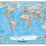 World NGS Classic Wall Map LARGE ENCAPSULATED
 World Michelin Wall Map ENCAPSULATED
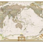
 World NGS Classic Pacific-Centered Wall Map LARGE ENCAPSULATED
 World NGS Executive Wall Map LARGE ENCAPSULATED
 World NGS Decorator Wall Map LARGE ENCAPSULATED
 World NGS Executive Pacific-Centered Wall Map LARGE ENCAPSULATED
 World NGS Physical Wall Map POSTER-SIZE ENCAPSULATED
 World Rand McNally Classic Wall Map ENCAPSULATED
 World Maps International Political Wall Map LARGE HANGING-STRIPS (without flags)
 World Rand McNally Signature Wall Map ENCAPSULATED
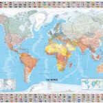
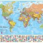 World Maps International Political Wall Map LARGE HANGING-STRIPS (with flags)
 Australasia Political Wall Map: ENCAPSULATED
 World Global Mapping Political Wall Map LARGE ENCAPSULATED
 World NGS Explorer Wall Map ENCAPSULATED
 World Hemispheres NGS Wall Map ENCAPSULATED
 World Executive Ray & Co Wall Map ENCAPSULATED
 South America NGS Classic Wall Map LARGE ENCAPSULATED
 USA Michelin Political Wall Map ENCAPSULATED
 World: Maps International Physical Wall Maps
 California NGS Wall Map ENCAPSULATED
 World Global Mapping Political Wall Map X-LARGE ENCAPSULATED
 United States NGS Decorator Wall Map LARGE ENCAPSULATED
 North America NGS Classic Wall Map LARGE ENCAPSULATED
 World Satellite Image NGS Wall Map ENCAPSULATED