Disclosure : This site contains affiliate links to products. We may receive a commission for purchases made through these links.
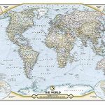
World Hemispheres NGS Wall Map PAPER
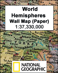
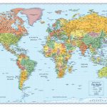
World Hemispheres Wall Map from the National Geographic, paper version – size 109 x 63cm (43″ x 25″ approx), with very attractive presentation of current political information in an elegant antique colouring. Countries are in rich but muted colours and oceans in beige, the style first adopted by the NGS in their very successful Executive range of world and country wall maps.Names of countries, cities and geographical features are given in their English version. Please note that the current edition still shows Sudan as one country. On land, relief shading shows the mountain ranges; peak heights are given in feet. Subtle but very effective graphics present the ocean floor, with names of ridges, plateaux, etc. The two hemispheres are accompanied by similar smaller circular maps of the northern and southern Polar Region. Latitude and longitude lines are drawn at 15ยฐ intervals.This map is also available encapsulated.

Related Products:
 World Hemispheres NGS Wall Map ENCAPSULATED
 World Global Mapping Antique Political Wall Map LARGE PAPER
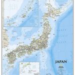
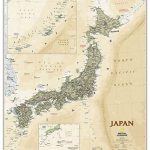 Japan NGS Executive Wall Map PAPER
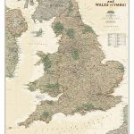 England and Wales NGS Executive Wall Map PAPER
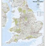 England and Wales NGS Classic Wall Map PAPER
 Stanford`s Eastern and Western Hemispheres Map (1877) – A3 Wall Map, Paper
Stanford`s Eastern and Western Hemispheres Map (1877) – A2 Wall Map, Paper
Stanford`s Eastern and Western Hemispheres Map (1877) – A1 Wall Map, Paper
Stanford`s Eastern and Western Hemispheres Map (1877) – A3 Wall Map, Paper
Stanford`s Eastern and Western Hemispheres Map (1877) – A2 Wall Map, Paper
Stanford`s Eastern and Western Hemispheres Map (1877) – A1 Wall Map, Paper
 The World – The National Geographic 125th Anniversary Wall Map PAPER
Stanford`s Eastern and Western Hemispheres Map (1877) – Original Size Wall Map, Paper
The World – The National Geographic 125th Anniversary Wall Map PAPER
Stanford`s Eastern and Western Hemispheres Map (1877) – Original Size Wall Map, Paper
 Japan NGS Classic Wall Map PAPER
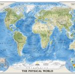 World NGS Physical Wall Map POSTER-SIZE PAPER
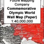 Future Map Company Commemorative Olympic World Wall Map PAPER
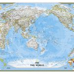
 World NGS Classic Wall Map PAPER
 World NGS Classic Wall Map LARGE PAPER
 World NGS Classic Wall Map POSTER-SIZE PAPER
 World NGS Explorer Wall Map PAPER
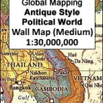
 World: Global Mapping Antique Style Political Wall Maps
 World NGS Classic Pacific-Centered Wall Map LARGE PAPER
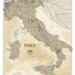 Italy NGS Executive Wall Map PAPER
 World NGS Classic Mural Wall Map 3-SHEET SET PAPER
 World NGS Executive Wall Map PAPER
 Italy NGS Classic Wall Map PAPER
World Maps International Glow in the Dark Wall Map
Italy NGS Classic Wall Map PAPER
World Maps International Glow in the Dark Wall Map
 Africa NGS Executive Wall Map PAPER
Mexico NGS Executive Wall Map PAPER
Africa NGS Executive Wall Map PAPER
Mexico NGS Executive Wall Map PAPER
 World NGS Executive Wall Map LARGE PAPER
 World NGS Executive Pacific-Centered Wall Map PAPER
Europe NGS Classic Wall Map PAPER
World NGS Executive Pacific-Centered Wall Map PAPER
Europe NGS Classic Wall Map PAPER
 World NGS Executive Pacific-Centered Wall Map LARGE PAPER
 World Global Mapping Political Wall Map LARGE PAPER
 Europe NGS Executive Wall Map PAPER
 World Rand McNally Signature Wall Map PAPER
 World Rand McNally Classic Wall Map PAPER
 World NGS Executive Mural Wall Map 3-SHEET SET PAPER
 Asia NGS Executive Wall Map PAPER
 Europe NGS Classic Wall Map LARGE PAPER
Stanford`s Eastern and Western Hemispheres Map (1877) – A3 Wall Map, Canvas
Stanford`s Eastern and Western Hemispheres Map (1877) – A2 Wall Map, Canvas
Stanford`s Eastern and Western Hemispheres Map (1877) – A1 Wall Map, Canvas
Europe NGS Classic Wall Map LARGE PAPER
Stanford`s Eastern and Western Hemispheres Map (1877) – A3 Wall Map, Canvas
Stanford`s Eastern and Western Hemispheres Map (1877) – A2 Wall Map, Canvas
Stanford`s Eastern and Western Hemispheres Map (1877) – A1 Wall Map, Canvas