Disclosure : This site contains affiliate links to products. We may receive a commission for purchases made through these links.
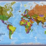
World Global Mapping Political Wall Map LARGE PAPER
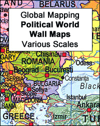
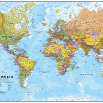
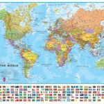
Political map of the world from Global Mapping, large size 138 x 95cm (54″ x 37.5″ approx.) ‘“ paper version, with bright colouring of the individual countries pleasantly contrasted by the light blue oceans, relief shading for mountain ranges on land and the structure of the ocean floor, a panel of country flags, etc. The map is part of Global Mapping series of political maps presenting the world in four different sizes, as indicated below. This particular version has not yet been updated to show South Sudan or the new International Date Line.GLOBAL MAPPING POLITICAL MAPS OF THE WORLD:FORMAT & SIZES: the maps are available on paper or encapsulated and in four sizes: 199 x 135cm, 138 x 95cm, 99.5 x 69.5cm and 69.5 x 61cm on paper but slightly larger when encapsulated ‘“ please see individual entries for exact measurements. PRESENTATION: country names are in English. Within Europe, city names are as used in their countries (Kรถln, Wien, Warszawa); elsewhere the names vary (e.g. Viangchan for Vientiane). In USA, Canada, Brazil and Australia the map shows names of states/provinces, with their borders and administrative capitals. Relief shading shows elevation on land and particularly effectively on the ocean floor. On all four sizes clocks show time difference from GMT (but without indicating the exact geographical area covered by each time zone); the International Date Line is not included on the smallest version. Small, medium and large size versions include a panel of country flags under the map.PLEASE NOTE: as the scale and the size of the map increases, each version includes more cities and more geographical information (mountain ranges, islands, etc).

Related Products:
 World Global Mapping Political Wall Map MEDIUM PAPER
 World Global Mapping Political Wall Map X-LARGE ENCAPSULATED
 World Global Mapping Political Wall Map LARGE ENCAPSULATED
World Global Mapping Political Wall Map MEDIUM ENCAPSULATED
World: Global Mapping Political Wall Maps
World Global Mapping Political Wall Map LARGE ENCAPSULATED
World Global Mapping Political Wall Map MEDIUM ENCAPSULATED
World: Global Mapping Political Wall Maps
 World Global Mapping Antique Political Wall Map LARGE PAPER
 World Maps International Political Wall Map X-LARGE PAPER
 World Global Mapping Political Wall Map X-LARGE PAPER
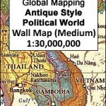
 World: Global Mapping Antique Style Political Wall Maps
 World Maps International Political UPSIDE-DOWN Wall Map LARGE PAPER
 World Maps International Political Wall Map X-LARGE PIN-BOARD FRAMED
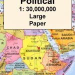 World Maps International Political Wall Map LARGE PAPER
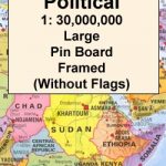 World Maps International Political Wall Map LARGE PIN-BOARD FRAMED without flags
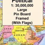 World Maps International Political Wall Map LARGE PIN-BOARD FRAMED with flags
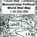 Future Mapping Company Monochrome Political World Wall Map PAPER
 World Maps International Political Wall Map X-LARGE MAGNETIC-BOARD FRAMED
 World Maps International Political Wall Map X-LARGE LAMINATED
 South East Asia Global Mapping Political Wall Map PAPER
 World Maps International Political Wall Map LARGE MAGNETIC-BOARD FRAMED with flags
 World Maps International Political Wall Map LARGE MAGNETIC-BOARD FRAMED without flags
 World Maps International Political Upside-down Wall Map LARGE ENCAPSULATED
 World Maps International Political Wall Map LARGE HANGING-STRIPS (without flags)
 South America Global Mapping Political Wall Map PAPER
 World Maps International Political Wall Map LARGE HANGING-STRIPS (with flags)
 Europe Maps International Political Wall Map X-LARGE PAPER
 Europe Maps International Political Wall Map PAPER LARGE
 World Maps International Political Wall Map SMALL PAPER
 World Maps International Political Wall Map MEDIUM PAPER
 World Maps International Political Wall Map LARGE ENCAPSULATED
 World Maps International Political Wall Map SMALL PIN-BOARD FRAMED without flags
 Environmental World Global Mapping Wall Map PAPER
 World Maps International Political Upside-down Wall Map LARGE HANGING-STRIPS
 World Maps International Political Wall Map SMALL PIN-BOARD FRAMED with flags
 World Maps International Political Wall Map MEDIUM PIN-BOARD FRAMED without flags
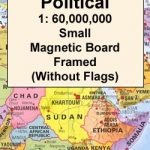
 Future Mapping Company Monochrome Political World Wall Map MAGNETIC
 World Maps International Political Wall Map MEDIUM PIN-BOARD FRAMED with flags
 Future Mapping Company Monochrome Political World Wall Map ENCAPSULATED
 British Isles Global Mapping Political Wall Map SMALL PAPER
 World Maps International Political Wall Map SMALL MAGNETIC-BOARD FRAMED without flags
 World Maps International Political Wall Map SMALL HANGING-STRIPS (without flags)