Disclosure : This site contains affiliate links to products. We may receive a commission for purchases made through these links.
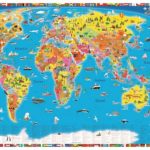
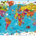
World Children`s Illustrated Political Kruger & Schonhoff Wall Map

Illustrated Political World map.This map includes interesting facts about the regions. History, culture, geography and nature as well as the countries` different sights impart general knowledge which is fun to learn and up to date.

Related Products:
 World Children`s Illustrated Political Kruger & Schonhoff Map Desk Mat
 World Children`s Illustrated Physical Kruger & Schonhoff Wall Map
 Animals of the World Illustrated Kruger & Schonhoff Wall Map
 Animals of the World Illustrated Kruger & Schonhoff Map Desk Mat
 Children`s Illustrated Atlas
 Children`s Illustrated World Atlas
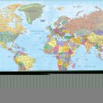
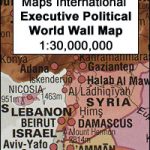 World Maps International Executive Political Wall Map
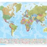
 World Political ITMB Wall Map
 Maps of the World: An Illustrated Children`s Atlas of Adventure, Culture, and Discovery
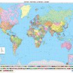
 World Political ITMB Wall Map LARGE
 World: National Geographic Society Decorator Style Political Wall Maps
 World Antique Political ITMB Wall Map
 LARGE
World Antique Political ITMB Wall Map
World Antique Political ITMB Wall Map LARGE
 World Marco Polo Political Wall Map
 Children`s Illustrated History Atlas
 Children`s Illustrated Animal Atlas
 World K+F Political 30M Wall Map LAMINATED
 World Collins Children`s Wall Map
 World K+F Political 30M Wall Map MEDIUM PIN-BOARD
 World F&B Political Wall Map LARGE
World Global Mapping Political Wall Map MEDIUM PAPER
World F&B Political Wall Map LARGE
World Global Mapping Political Wall Map MEDIUM PAPER
 World Global Mapping Political Wall Map LARGE PAPER
 World Norstedts Black & White Political Wall Map
 NGS Classic Political World Wall Map ENLARGED, PIN BOARD, FRAMED
 World F&B Political Wall Map MEDIUM
 World: Freytag & Berndt Political Wall Maps
 World Maps International Political UPSIDE-DOWN Wall Map LARGE PAPER
World: Global Mapping Political Wall Maps
World Maps International Political UPSIDE-DOWN Wall Map LARGE PAPER
World: Global Mapping Political Wall Maps
 World Political – Sea Relief F&B Wall Map LAMINATED
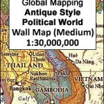
 World: Global Mapping Antique Style Political Wall Maps
 World F&B Political Wall Map MEDIUM – with Metal Hanging Strips
 Political World Map
 World F&B Political – Sea Relief Wall Map XXL LAMINATED
 World Global Mapping Antique Political Wall Map LARGE PAPER
World Global Mapping Political Wall Map LARGE ENCAPSULATED
World Global Mapping Political Wall Map MEDIUM ENCAPSULATED
World: Kรผmmerly + Frey Political Wall Maps
World Global Mapping Antique Political Wall Map LARGE PAPER
World Global Mapping Political Wall Map LARGE ENCAPSULATED
World Global Mapping Political Wall Map MEDIUM ENCAPSULATED
World: Kรผmmerly + Frey Political Wall Maps
 Maps of the World`s Oceans: An Illustrated Children`s Atlas to the Seas and all the Creatures and Plants that Live There
 World: Freytag & Berndt Political/Physical World Wall Maps
 World Schofield & Sims Political Wall Map