Disclosure : This site contains affiliate links to products. We may receive a commission for purchases made through these links.
Wood Green 1935 – 7.4
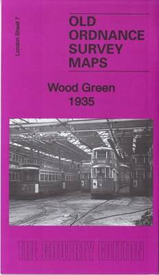
Wood Green in 1935 in a fascinating series of reproductions of old Ordnance Survey plans in the Alan Godfrey Editions, ideal for anyone interested in the history of their neighbourhood or family. Three versions have been published for this area, stretching from Dagmar Road eastward to Hatherley Road and Boundary Road, and from Spencer Avenue southward to Gladstone Avenue. Features include Wood Green (now Alexandra Park) station, Bowes Park, Noel Park and Palace Gates stations, Royal Masonic Institution, Wood Green Common, Banquet Hall of Alexandra Park, St Gabriel`s church Bowes Park, Chitts Hill House, White Hart Lane Potteries, Wolves Lane. Green Lanes runs north-south through the centre of the map. Each maps has on reverse extracts from contemporary street directories.About the Alan Godfrey Editions of the 25″ OS Series:Selected towns in Great Britain and Ireland are covered by maps showing the extent of urban development in the last decades of the 19th and early 20th century. The plans have been taken from the Ordnance Survey mapping and reprinted at about 15 inches to one mile (1:4,340). On the reverse most maps have historical notes and many also include extracts from contemporary directories. Most maps cover about one mile (1.6kms) north/south, one and a half miles (2.4kms) across; adjoining sheets can be combined to provide wider coverage.FOR MORE INFORMATION AND A COMPLETE LIST OF ALL AVAILABLE TITLES PLEASE CLICK ON THE SERIES LINK.

Related Products:
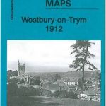
 Wood Green 1912 – 7.3
 Wood Green 1894 – 7.2
 Hornsey & Green Lanes 1935 – 12.4
 Muswell Hill 1935 – 11.4
 South Harrow and Northolt Park 1935
 Alexandra Park and South Friern 1935
 Palmers Green 1912 – 7.14a
 South Acton & Gunnersbury Park 1935 – 71.4
 Southall Green 1935
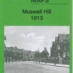 Muswell Hill 1913 – 11.3
Kensal Green & Queen`s Park 1894 – 47.2
Muswell Hill 1913 – 11.3
Kensal Green & Queen`s Park 1894 – 47.2
 Wavertree and Broad Green 1905
Kensal Green & West Kilburn 1865 – 47.1
Wavertree and Broad Green 1905
Kensal Green & West Kilburn 1865 – 47.1
 Alexandra Park & South Friern 1894 – 6a
 Alexandra Park & South Friern 1911 – 6b
 Northolt 1935
 St John`s Wood 1868
 Hindley Green 1906
Bellshill 1935 – 11.08
Hindley Green 1906
Bellshill 1935 – 11.08
 West Drayton South 1935
Friern Barnet and New Southgate 1898
Hall Green 1903
Hornsey 1894 – 12.2
West Drayton South 1935
Friern Barnet and New Southgate 1898
Hall Green 1903
Hornsey 1894 – 12.2
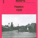 Heston 1935
Tannochside & North Uddingston 1935 – 11.03
Heston 1935
Tannochside & North Uddingston 1935 – 11.03
 Edgware 1935
 Bromley North and Sundridge Park 1895
 Wealdstone and Hatch End 1935
Nottingham NW (New Basford & Hyson Green) 1913 – 38.13
Wealdstone and Hatch End 1935
Nottingham NW (New Basford & Hyson Green) 1913 – 38.13
 Lewisham 1914 – 119.3
 Eltham Green 1894 – 120.2
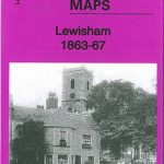 Lewisham 1863-67 – 119.1
Sheffield Park 1903
Lewisham 1863-67 – 119.1
Sheffield Park 1903
 Bethnal Green & Bow 1914 – 52.3
 Bethnal Green & Bow 1894 – 52.2
Bethnal Green & Bow 1870 – 52.1
Wylde Green 1913
Wanstead 1915 – 24.3
Bethnal Green & Bow 1894 – 52.2
Bethnal Green & Bow 1870 – 52.1
Wylde Green 1913
Wanstead 1915 – 24.3
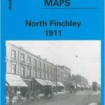 North Finchley 1911
 Finsbury Park & Stroud Green 1870 – 20.1