Disclosure : This site contains affiliate links to products. We may receive a commission for purchases made through these links.
Winchmore Hill 1896 – 7.10a
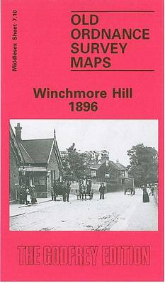
Winchmore Hill in 1896 in a fascinating series of reproductions of old Ordnance Survey plans in the Alan Godfrey Editions, ideal for anyone interested in the history of their neighbourhood or family. The map covers Winchmore Hill, stretching from Memorial Terrace and Vicars Moor Lane southward to Stonard Road, and east to the New River and Highfield Row; Winchmorehill (spelt as one word on the map) is here shown as a modest sized village, with its station, St Paul`s church, Rosneath House, and scattering of streets. To the west of the village is Grovelands and the Deer Park, grounds landscaped by Humphry Repton. Beyond this is Bourneside and to the foot of the map is Clappers Green, with a small section of Southgate, including The Green, in the south-western corner. A directory of Winchmore Hill is on the reverse.About the Alan Godfrey Editions of the 25″ OS Series:Selected towns in Great Britain and Ireland are covered by maps showing the extent of urban development in the last decades of the 19th and early 20th century. The plans have been taken from the Ordnance Survey mapping and reprinted at about 15 inches to one mile (1:4,340). On the reverse most maps have historical notes and many also include extracts from contemporary directories. Most maps cover about one mile (1.6kms) north/south, one and a half miles (2.4kms) across; adjoining sheets can be combined to provide wider coverage.FOR MORE INFORMATION AND A COMPLETE LIST OF ALL AVAILABLE TITLES PLEASE CLICK ON THE SERIES LINK.

Related Products:
 Norton 1896
 Mill Hill Village 1898
Streatham Hill & Tulse Hill 1914 – 126.3
Mill Hill Village 1898
Streatham Hill & Tulse Hill 1914 – 126.3
 Streatham Hill & Tulse Hill 1894 – 126.2
 Holmside and Edmondsley 1896
West Twickenham & Strawberry Hill 1894 – 121a
Griffin`s Hill 1902
Holmside and Edmondsley 1896
West Twickenham & Strawberry Hill 1894 – 121a
Griffin`s Hill 1902
 West Twickenham & Strawberry Hill 1934 – 121b
Bishop Middleham & Mainsforth Hall 1896 – 35.15
West Twickenham & Strawberry Hill 1934 – 121b
Bishop Middleham & Mainsforth Hall 1896 – 35.15
 Cricklewood and Child`s Hill 1912
Chigwell Row and Grange Hill 1914
Cricklewood and Child`s Hill 1912
Chigwell Row and Grange Hill 1914
 Muswell Hill 1935 – 11.4
 Muswell Hill 1913 – 11.3
Washington 1896
Crook East 1896
Muswell Hill 1913 – 11.3
Washington 1896
Crook East 1896
 Monken Hadley 1896
 Hexham 1896
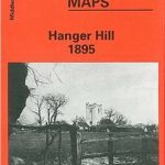 Hanger Hill 1895
Milngavie 1896
Lanark 1896 – 25.15
Hanger Hill 1895
Milngavie 1896
Lanark 1896 – 25.15
 Poynton West 1896
Annfield Plain 1896
Poynton West 1896
Annfield Plain 1896
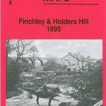 Finchley and Holders Hill 1895
 Watford South and New Bushey 1896
Broomhouse, Daldowie and Haughead 1896
Watford South and New Bushey 1896
Broomhouse, Daldowie and Haughead 1896
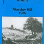 Mossley Hill 1905
Darlington North 1896
Mossley Hill 1905
Darlington North 1896
 Walton on the Hill 1906
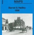 Barnet and Hadley 1896
Isles of Scilly 1896
Leyland 1909
Wishaw 1896
Bishop Auckland 1896 – 42.02a
Barnet and Hadley 1896
Isles of Scilly 1896
Leyland 1909
Wishaw 1896
Bishop Auckland 1896 – 42.02a
 Shooters Hill 1866 – 107.1
Arthur`s Hill and Fenham 1913
Wivenhoe 1896
Darlaston & King`s Hill 1901
Teddington & Hampton Hill 1894 – 131.2
Shooters Hill 1866 – 107.1
Arthur`s Hill and Fenham 1913
Wivenhoe 1896
Darlaston & King`s Hill 1901
Teddington & Hampton Hill 1894 – 131.2
 New Hartley and Delaval Hall 1896
North Calder & Douglas Support 1896 – 11.04
New Hartley and Delaval Hall 1896
North Calder & Douglas Support 1896 – 11.04