Disclosure : This site contains affiliate links to products. We may receive a commission for purchases made through these links.
Willesden Junction 1894
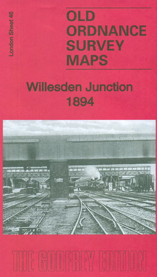
Willesden Junction in 1894 in a fascinating series of reproductions of old Ordnance Survey plans in the Alan Godfrey Editions, ideal for anyone interested in the history of their neighbourhood or family. Four versions of this map have been published and will be of special interest to transport historians. Willesden Junction station is central to the map and around it various lines fan out. Railway features (from the 1913 map) include a stretch of the GWR, including engine shed and carriage shed, West London Junction, Old Oak Common Sidings, Acton Wells Junction, Old Oak Junction, GWR Victoria Branch, Mitre Bridge Junction. Also here are part of the Midland Railway Acton Branch, the GWR Acton & Northolt line, the LNWR West London Line, the main LNWR line, the Hampstead Junction Line with Kensal Green Junction, engine shed and carriage sheds. All this is in good detail, with tracks, turntables, signal-boxes, signal posts. There is also a stretch of the Paddington Branch Canal. North of the junction is much of Harlesden, including High Street, Harlesden Lodge, Station Road. Other smaller communities are squeezed between tracks, including Goodhall Street and Old Oak Lane; Lower Place in the north-west corner; Wells House Road near the foot of the map; College Park, including Scrubbs Lane, Waldo Road, near the eastern edge of the map. Also St Mary`s RC Cemetery, Cumberland Park Factory and various works along Hythe Road. The four maps show the area getting progressively busier; the 1868 version still has many fields between the lines, also Kensal Green & Harlesden station, Manor House, Wells House. The 1894 version includes street directories for Acton Lane, Harlesden High Street and Station Road. The 1868 version has 1897 railway timetables for Willesden-Waterloo, Willesden-Victoria, Willesden-Kensington, Willesden-Croydon lines. The 1935 version has the A-F entries from a 1935 Harlesden directory.About the Alan Godfrey Editions of the 25″ OS Series:Selected towns in Great Britain and Ireland are covered by maps showing the extent of urban development in the last decades of the 19th and early 20th century. The plans have been taken from the Ordnance Survey mapping and reprinted at about 15 inches to one mile (1:4,340). On the reverse most maps have historical notes and many also include extracts from contemporary directories. Most maps cover about one mile (1.6kms) north/south, one and a half miles (2.4kms) across; adjoining sheets can be combined to provide wider coverage.FOR MORE INFORMATION AND A COMPLETE LIST OF ALL AVAILABLE TITLES PLEASE CLICK ON THE SERIES LINK.

Related Products:
 Willesden and Stonebridge Park 1936
Pollokshields 1894
Willesden and Stonebridge Park 1936
Pollokshields 1894
 Macauley`s Station Map of the 1881 Railways of Great Britain and Airey`s Junction Diagrams
 Kensal Green & Queen`s Park 1894 – 47.2
Upper Holloway 1894 – 29.2
Kensal Green & Queen`s Park 1894 – 47.2
Upper Holloway 1894 – 29.2
 Kentish Town & Camden 1894 – 38.2
 East Acton & Wormwood Scrubs 1894 – 58.2
St Rollox 1894 – 6.07a
Poplar 1894 – 65.2
East Acton & Wormwood Scrubs 1894 – 58.2
St Rollox 1894 – 6.07a
Poplar 1894 – 65.2
 Pre-Grouping Atlas and RCH Junction Diagrams
 Bootle 1907
Partick 1894 – 6.05
Bootle 1907
Partick 1894 – 6.05
 Dalston 1894 – 40.2
 Crystal Palace, Anerley and Upper Norwood 1894 – 145
Newcastle & Gateshead 1894 – 18a
Crystal Palace, Anerley and Upper Norwood 1894 – 145
Newcastle & Gateshead 1894 – 18a
 Hanger Hill 1895
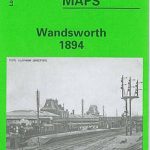 Wandsworth 1894 – 114a
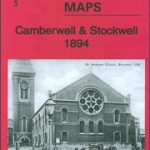 Camberwell & Stockwell 1894 – 102.2
 Shropshire Union Canal, incl. Middlewich Branch & up to Gr. Haywood Junction Heron Map
Hounslow West 1894 – 20.06a
Shropshire Union Canal, incl. Middlewich Branch & up to Gr. Haywood Junction Heron Map
Hounslow West 1894 – 20.06a
 Lostock Junction 1907
 Chelsea & West Brompton 1894 – 87.2
 Walsall (SW) & Pleck 1901 – 63.10a
 South Acton & Gunnersbury Park 1935 – 71.4
Gravelly Hill 1902
Nottingham (South) 1899 – 42.06b
Middlesbrough North 1913
Carlisle South-West 1924
Central Newcastle 1894 – 11a
South Acton & Gunnersbury Park 1935 – 71.4
Gravelly Hill 1902
Nottingham (South) 1899 – 42.06b
Middlesbrough North 1913
Carlisle South-West 1924
Central Newcastle 1894 – 11a
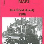 Bradford East 1906
 Walsall (NE) 1913 – 63.07
Middlesbrough North 1893 (Colour Edition)
Walsall (NE) 1913 – 63.07
Middlesbrough North 1893 (Colour Edition)
 Brixton & Herne Hill 1894 – 116.2
Friesland West ANWB Cycling Junction Map 2
Groningen West ANWB Cycling Junction Map 4
Brixton & Herne Hill 1894 – 116.2
Friesland West ANWB Cycling Junction Map 2
Groningen West ANWB Cycling Junction Map 4
 Streatham Hill & Tulse Hill 1894 – 126.2
 Highbury & Islington 1894 – 39.2
North Finchley 1894
West Norwood 1894 – 136.2
Highbury & Islington 1894 – 39.2
North Finchley 1894
West Norwood 1894 – 136.2
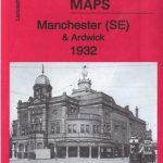 Manchester SE & Ardwick 1932 – 104.11b