Disclosure : This site contains affiliate links to products. We may receive a commission for purchases made through these links.
Whitstable (North) 1906 – 23.10
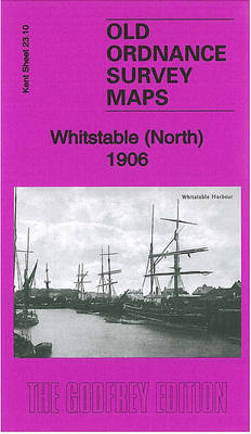
Whitstable North in 1906 in a fascinating series of reproductions of old Ordnance Survey plans in the Alan Godfrey Editions, ideal for anyone interested in the history of their neighbourhood or family. Three separate titles cover the town:- Sheet 23.10 Whitstable North covers the Harbour, Tankerton Castle, the coastal development of Tankerton, Priest & Sow Corner, Kingsdown Park, RC Church, Whitstable Branch station, etc. Sheet 23.09 covering Harbour Street and Sea Street is included as an inset.- Sheet 23.13 Whitstable West covers the High Street and Canterbury Road area, with coverage westward to Seasalter Cliff Coastguard Station; features include shipbuilding yards, Borstalhill Farm, Lower Island, Seasalter Road, Parsonage Farm etc.- Sheet 23.14 Whitstable East covers the area from Whitstable station eastward to Rayham Farm and Ridgeway. Features include All Saints church, Church Street, Mill Strood Farm, Downshouse Farm, Gorrell Bridge, Duncan Down, Rayham Crossing etc. The maps include extensive extracts from a 1905 directory for Whitstable and Tankerton, listing many of the residents and businesses of the time.About the Alan Godfrey Editions of the 25″ OS Series:Selected towns in Great Britain and Ireland are covered by maps showing the extent of urban development in the last decades of the 19th and early 20th century. The plans have been taken from the Ordnance Survey mapping and reprinted at about 15 inches to one mile (1:4,340). On the reverse most maps have historical notes and many also include extracts from contemporary directories. Most maps cover about one mile (1.6kms) north/south, one and a half miles (2.4kms) across; adjoining sheets can be combined to provide wider coverage.FOR MORE INFORMATION AND A COMPLETE LIST OF ALL AVAILABLE TITLES PLEASE CLICK ON THE SERIES LINK.

Related Products:
 Whitstable East 1906
 Whitstable West 1905
 Liverpool North 1906
 Helston 1906
 Bradford North 1906
 Hurst and North Ashton 1906
 Kirkdale 1906
 Rainhill 1906
 St Ives 1906
 Sevenoaks North and Riverhead 1907
Redruth 1906
Sevenoaks North and Riverhead 1907
Redruth 1906
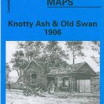 Knotty Ash and Old Swan 1906
Plymouth North 1893
Knotty Ash and Old Swan 1906
Plymouth North 1893
 Bromley Common and North-East Hayes 1895
Hindley Green 1906
Penryn 1906
Knutsford North 1908
Bromley Common and North-East Hayes 1895
Hindley Green 1906
Penryn 1906
Knutsford North 1908
 Ebbw Vale North 1899
Wadebridge 1906
Dumfries North 1899
Ebbw Vale North 1899
Wadebridge 1906
Dumfries North 1899
 Walton on the Hill 1906
 Central Liverpool 1906 – 106.14b
Willenhall North East 1885
Aintree 1906
Newton-le-Willows 1906
Worcester North-East 1902
North Shields and Chirton 1894
Northfield North 1903
Central Liverpool 1906 – 106.14b
Willenhall North East 1885
Aintree 1906
Newton-le-Willows 1906
Worcester North-East 1902
North Shields and Chirton 1894
Northfield North 1903
 Peebles 1906 – 13.06
 Cambridge (North) 1901 – 40.14
Devonport North 1893
Cambridge (North) 1901 – 40.14
Devonport North 1893
 Bradford Central 1906
 Hull North East 1908
 Bromley North and Sundridge Park 1895
 St. Andrews 1893 – 9.10
 Northwich North East 1908
 Leeds South and South East 1906
Colwyn Bay North 1911
Leeds South and South East 1906
Colwyn Bay North 1911
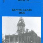 Central Leeds 1906 – 218.02b
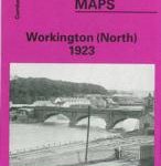 Workington North 1923