Disclosure : This site contains affiliate links to products. We may receive a commission for purchases made through these links.
Whiston 1925
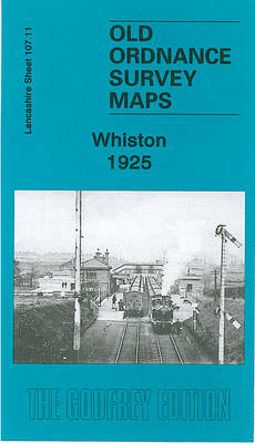
Whiston in 1925 in a fascinating series of reproductions of old Ordnance Survey plans in the Alan Godfrey Editions, ideal for anyone interested in the history of their neighbourhood or family. The map covers the village of Whiston, midway between Liverpool and Warrington. Coverage stretches from Prescot station southward to Whiston Lane Ends, and from Dales Row and Latham`s Farm eastward to Cumber Lane Farm and the Whiston Poor Law Institution. Other features on a relatively rural map include stretches of the Liverpool & Manchester and Huyton & St Helens railways, Whiston Cross, Tushingham Metallic Brick Works, with mineral railway, Platt`s Bridge, an iron foundry (now Stoves Ltd), Royal Oak Farm, Shaw Lane Farm, etc. About the Alan Godfrey Editions of the 25″ OS Series:Selected towns in Great Britain and Ireland are covered by maps showing the extent of urban development in the last decades of the 19th and early 20th century. The plans have been taken from the Ordnance Survey mapping and reprinted at about 15 inches to one mile (1:4,340). On the reverse most maps have historical notes and many also include extracts from contemporary directories. Most maps cover about one mile (1.6kms) north/south, one and a half miles (2.4kms) across; adjoining sheets can be combined to provide wider coverage.FOR MORE INFORMATION AND A COMPLETE LIST OF ALL AVAILABLE TITLES PLEASE CLICK ON THE SERIES LINK.

Related Products:
 Quinton 1902
 Walton on the Hill 1906
 Gateacre 1904
Coombeswood 1914
Rotherham South 1901
Gateacre 1904
Coombeswood 1914
Rotherham South 1901
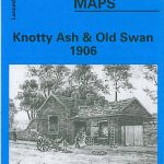 Knotty Ash and Old Swan 1906
Ruislip 1939
Knotty Ash and Old Swan 1906
Ruislip 1939
 Wavertree and Broad Green 1905
Harborne South 1901
Wavertree and Broad Green 1905
Harborne South 1901
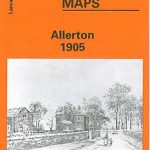 Allerton 1905
 Hazel Grove 1897
Anfield 1908 – 106.07b
Lostock Hall and Farington North 1909
Timperley 1897
Hazel Grove 1897
Anfield 1908 – 106.07b
Lostock Hall and Farington North 1909
Timperley 1897
 Woolton 1904
 Wickersley 1901
Selly Oak and Bournville 1903
Sunderland South 1895
Wickersley 1901
Selly Oak and Bournville 1903
Sunderland South 1895
 Palmers Green 1912 – 7.14a
Rose Grove and Habergham 1909
Aintree 1906
Lower Irlam and Cadishead 1926
Palmers Green 1912 – 7.14a
Rose Grove and Habergham 1909
Aintree 1906
Lower Irlam and Cadishead 1926
 Romiley 1897
 West Drayton South 1935
 Hunmanby 1926
Cambridge 1925 – 47.02b
Hunmanby 1926
Cambridge 1925 – 47.02b
 Liverpool Toxteth Mill Street 1847
Willesden and Stonebridge Park 1936
East Jarrow 1913
Liverpool Toxteth Mill Street 1847
Willesden and Stonebridge Park 1936
East Jarrow 1913
 Bexley Heath 1862
 Liverpool Vauxhall 1864
Liverpool Wapping 1864
Cathcart 1910
Liverpool Vauxhall 1864
Liverpool Wapping 1864
Cathcart 1910
 Rainhill 1906
Easington Lane and Bryn Gates 1896
Northfield South 1903
Rainhill 1906
Easington Lane and Bryn Gates 1896
Northfield South 1903
 Liverpool Shaw Street 1848
 Liverpool Hanover Street 1864
Bidston 1898
Liverpool London Road 1864
Liverpool Hanover Street 1864
Bidston 1898
Liverpool London Road 1864