Disclosure : This site contains affiliate links to products. We may receive a commission for purchases made through these links.
Weymouth 1901

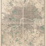
Weymouth in 1901 in a fascinating series of reproductions of old Ordnance Survey plans in the Alan Godfrey Editions, ideal for anyone interested in the history of their neighbourhood or family. Weymouth is covered by a block of three maps. On this main Weymouth map is the town centre, with coverage stretching from Westerhall Road and Carlton Road southward to Belle Vue Road, the Portland Breakwater or Bincleaves Groyne. Features include Melcombe Regis, station, Hotel Burdon, eastern edge of Radipole Lake, Gloucester Hotel, St Thomas`s Street, Pile Pier, railway to harbour, Custom House Quay, Alexandra Gardens, Weymouth Bridge, Harbour, Trinity Road, Nothe Point, Hope Square, Weymouth Brewery, Hope Brewery, malthouses, Bincleave Rocks, shipbuilding yards. On the back is a list of private residents from a contemporary directory. The Weymouth Westham map covers the noth-western area of the town, stretching from the North Quay and High West Street northward to Chafey`s Lake, and westward to the Marquis Farm, and Marquis of Granby pub. Features include Melcombe Regis Burial Ground, Abbotsbury Road, Chickerell Road, Weymouth Burial Ground, Gas Works, Newstead Road, much of Radipole Lake. On the back is an extract from the commercial directory for Weymouth, entries A to G.The Wyke Regis map covers the south-west of the town and is double-sided for maximum coverage. The main map covers the area from Rodwell and Rodwell Road southward to Park Mead Farm, and westward to Wyke Regis, still largely a separate village. Features in Weymouth include the Workhouse, Rodwell station, Belfield House, Sandsfoot Castle, St Nicholas church, Springfield, Wyke Road. Features in Wyke include All Saints church, Wyke House. On the reverse a large extract from sheet 58.02, continues coverage southward to the Chesil Bank; Portland Bridge and Small Mouth are in the centre of this map, which shows the link between Portland and Weymouth. Features here include East Fleet, Royal Victoria Hotel. About the Alan Godfrey Editions of the 25″ OS SeriesSelected towns in Great Britain and Ireland are covered by maps showing the extent of urban development in the last decades of the 19th and early 20th century. The plans have been taken from the Ordnance Survey mapping and reprinted at about 15 inches to one mile (1:4,340). On the reverse most maps have historical notes and many also include extracts from contemporary directories. Most maps cover about one mile (1.6kms) north/south, one and a half miles (2.4kms) across; adjoining sheets can be combined to provide wider coverage.FOR MORE INFORMATION AND A COMPLETE LIST OF ALL AVAILABLE TITLES PLEASE CLICK ON THE SERIES LINK.

Related Products:
 Weymouth Westham 1901
Wyke Regis 1901
Weymouth Westham 1901
Wyke Regis 1901
 Weymouth A-Z Pocket Street Map
 Bangor West 1901
 Portland & Weymouth 1912 – 341/342
 Harborne 1901
 Portland & Weymouth Walking Map 49 – Ferrybridge to Ringstead Bay
Loughborough 1901
Harborne South 1901
Portland & Weymouth Walking Map 49 – Ferrybridge to Ringstead Bay
Loughborough 1901
Harborne South 1901
 Walsall (SE) 1901 – 63.11
Newtownards 1901
Wolverhampton (SW) 1901 – 62.10
Bridgnorth 1901
Bridport 1901
Ely 1901 – 26.14
Donaghadee 1901
Walsall (SE) 1901 – 63.11
Newtownards 1901
Wolverhampton (SW) 1901 – 62.10
Bridgnorth 1901
Bridport 1901
Ely 1901 – 26.14
Donaghadee 1901
 Wickersley 1901
Wolverhampton North West 1901
Edgbaston 1901
Stourport 1901
Bangor East 1901
Wickersley 1901
Wolverhampton North West 1901
Edgbaston 1901
Stourport 1901
Bangor East 1901
 Cradley Heath and Old Hill 1901
 Weymouth – Dorchester A-Z Street Atlas
Wath upon Dearne 1901
Dundee West 1901
Weymouth – Dorchester A-Z Street Atlas
Wath upon Dearne 1901
Dundee West 1901
 Purbeck & South Dorset – Poole, Dorchester – Weymouth & Swanage OS Explorer Map OL15 (paper)
Swinton 1901
Purbeck & South Dorset – Poole, Dorchester – Weymouth & Swanage OS Explorer Map OL15 (paper)
Swinton 1901
 Purbeck & South Dorset – Poole, Dorchester – Weymouth & Swanage OS Explorer Active Map OL15 (waterproof)
 Buxton 1897 – 15.13
 Cambridge (North) 1901 – 40.14
 Canning Town & Custom House 1894 – 66.2
 Canning Town & Custom House 1914 – 66.3
Sherborne 1901
The Cheviot 1901-13 – 5
Halesowen (West) 1901 – 4.16
Canning Town & Custom House 1914 – 66.3
Sherborne 1901
The Cheviot 1901-13 – 5
Halesowen (West) 1901 – 4.16
 Sedgley South-East with Swan Village and West Coseley 1901
 Dorchester, Weymouth, Cerne Abbas & Bere Regis OS Landranger Map 194 (paper)
Smethwick 1901 – 72.03a
Dorchester, Weymouth, Cerne Abbas & Bere Regis OS Landranger Map 194 (paper)
Smethwick 1901 – 72.03a
 Wolverhampton (SE) 1901 – 62.11b
 Dorchester, Weymouth, Cerne Abbas & Bere Regis OS Landranger Active Map 194 (waterproof)