Disclosure : This site contains affiliate links to products. We may receive a commission for purchases made through these links.
Western Fjords
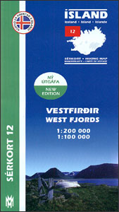
The north-western tip of Iceland in a series of detailed hiking and recreational topographic maps from Mรกl og menning ‘“ the country’s leading cartographic publishers, with beautiful drawings of local birds and tourist information. On one side the whole area is covered by a road map at 1:200,000, on the reverse its south-western part is shown in greater detail at 1:50,000. Contour lines are at 100m and 20m intervals respectively.Maps in this series present very detailed picture of country’s topography, with contours at 20m intervals supplemented by spot heights and relief shading. Colouring and/or graphics indicate different types of terrain and vegetation: lava, sand and mudflats, glaciers, etc. Road network includes gravel roads and tracks, indicating fords across rivers and streams. Footpaths and bridleways are marked and symbols indicate locations of campsites, tourist huts and shelters, emergency shelters, golf courses and swimming pools, hydro-electric or geothermal power stations, etc. Each title carries on the reverse an enlargement of the most interesting area, descriptions of main sights, plus beautiful detailed drawings of over 35 local birds (Latin and English names are included). Map legend and the descriptions include English.To see the list of titles in this series please click on the series link.

Related Products:
 Iceland Western Fjords
 Snรฆfellsnes
 Hornstrandir
 Skaftafell
 Reykjanes – รingvellir
 Lรณnsรถrรฆfi – Snรฆfell
 Gullfoss – Geysir – Hekla
 Kjรถlur – Langjรถkull – Kerlingrafjรถll
 Akureyri – Mรฝvatn – Dettifoss
Askja – Herdubreid – Kverkfjรถll
Akureyri – Mรฝvatn – Dettifoss
Askja – Herdubreid – Kverkfjรถll
 Landmannalaugar – รorsmork – Fjallabak – Eyjafjallajokull Volcano
 Iceland: Mรกl og Menning Touring and Hiking Maps
 Iceland West: Akranes – Eirรญksjรถkull Glacier
 Iceland Cental: Langjรถkull – Hofsjรถkull – Vatnajรถkull
 Iceland South-West: Reykjavik ‘“ Eyjafjallajรถkull
 Tatras Western: Koscielisko and the Western Valleys (Tatry Zachodnie)
 Iceland North: Hvammstangi – Mรฝvatn Lake
 Iceland: Mรกl og Menning 200K Road Maps
 Iceland North East: Hรบsavik – Lake Mรฝvatn – Bakkagerรฐi
 Iceland South East: Southern Vatnajรถkull
 Iceland East: Vatnajรถkull – Egilsstaรฐir
 Western Tatras – Polish and Slovak
 Western Scotland & the Western Isles OS Road Map 2
 Alta Via dei Monti Liguri Western Part: from Passo del Faiallo to Passo dei Giovi 25K Ed. Multigraphic Map No. AVML1
 Western Rhodopes / Rodopi – Falakro Geopsis 133
 Western USA – South Western Canada Michelin Regional 585
 Western Svealand Norstedts Regional Map 2
 Western Rhodope Mountains Domino Map
 South-Western Greenland Special Map
 South-Western Nicaragua – Masaya – Granada
 Canada Central: Western Ontario, Manitoba, Saskatchewan Reise-Know-How Map
 Western Australia Hema
 Mid West Western Australia Hema
 Costa del Maule
 USA Rail Museums & Trips – Western States Bella Terra Illustrated Map
 Chamba, Dhauladhar Passes, Pangi Valley & Western Lahul
 Europe Western F&B
 Western Nepal Rafting and Kayaking Map
 Galicica National Park
 Beskid Niski: Western Part