Disclosure : This site contains affiliate links to products. We may receive a commission for purchases made through these links.
Categories
-
Best Sellers
-

Carcassonne – Alzonne IGN 2345SB
Topographic survey of France at 1:25,000 in IGN`s excellent TOP25 / Sรฉrie Bleue series. All the maps are GPS compatible, with a 1km UTM grid plus Read More » -

Smell of Summer Grass: Pursuing Happiness at Perch Hill
The Smell of Summer Grass is the story of the years spent in finding and building a personal idyll, sometimes a dream, sometimes a nightmare, by Read More » -
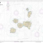
NOAA Chart 16501 – Islands of Four Mountains
NOAA maintains the nautical charts and publications for U.S. coasts and the Great Lakes. Over a thousand charts cover 95,000 miles of shoreline and 3.4 million Read More » -

Portrait of Bolognia
Bologna is a town for the pleasure of the eyes… red for its beautiful sunsets on the red roof tiles, spiked with belltowers, with its historic Read More » -

Surfacing
Collective Winner of the 2019 Highland Book PrizeUnder the ravishing light of an Alaskan sky, objects are spilling from the thawing tundra linking a Yup`ik village Read More » -
How to be a Global Citizen: Be Informed. Get Involved.
Are you an aspiring activist or a curious community member? Then this is the perfect guide for you!Young people around the world are more aware than Read More » -
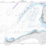
NGA Chart 27122 – Golfo de Guanahacabibes
Produced by the US Government, National Geospatial-Intelligence Agency (NGA) charts provide information for the International Waters. They are printed on demand at our London shop and Read More » -

Saint-Pourcain-sur-Sioule – Jaligny-sur-Besbre IGN 2628SB
Topographic survey of France at 1:25,000 in IGN`s excellent TOP25 / Sรฉrie Bleue series. All the maps are GPS compatible, with a 1km UTM grid plus Read More » -

The Lost World of Communism
1989 was a year of revolution: it marked the collapse of communism in Eastern and Central Europe and an end to an entire way of life Read More » -

C70 Southern North Sea Passage Chart
Imray’s series of charts of Northwest Europe are comprehensive and easy-to-use sailing charts published on rip-proof, waterproof paper- ideal for use on small tables or in Read More »
-


