Disclosure : This site contains affiliate links to products. We may receive a commission for purchases made through these links.
West Highland Way Harvey National Trail XT40
The West Highland Way, Scotland’s premier 153km / 96 miles long trail from Milngavie near Glasgow along Loch Lomond to Fort William presented at 1:40,000 on a light, waterproof and tear-resistant map from Harvey Map Services. The whole route is covered by nine overlapping panels, and the map includes small street plan of Milngavie, Tyndrum, Kinlochleven and Fort William. Map legend and addition notes with useful advice on access to the route from Glasgow, etc. are also in German and in French.Maps in the Harvey’s series covering Great Britain’s national trails and other long-distance footpaths are printed on light, waterproof and tear-resistant synthetic paper and cover the routes at 1:40,000 or 1:60,000. Topography is shown by contours at 15m intervals, with additional spot heights plus colouring and/or graphics to provide a very detailed picture of the terrain (boulder fields, scree, crags, etc) and vegetation / land use (pastures, moorland, woodlands, etc). In Scotland peaks and hills classified as Munros, Corbetts and Donalds are marked. The overprint for the long-distance trail shows sections on local or main roads (highlighting danger points), on tracks, and on footpaths, indicating intermittent or not visible paths. The maps also show other right of way paths, including permissive paths and bridleways. Symbols indicate various facilities and accommodation options (including campsites and youth hostels), pubs and refreshments, food shops, banks, information points, etc, both along the route itself and in the nearby locations. All maps are GPS compatible, with the British National Grid overprinted on each panel. The maps also include useful contact details and general advice.To see other titles in this series please click on the series link.

Related Products:
 East Highland Way Harvey National Trail XT40
 Cape Wrath Trail South – Fort William to Strathcarron Harvey National Trail XT40
 Great Glen Way Harvey National Trail XT40
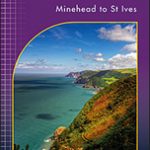 South West Coast Path 1 – Minehead to St Ives Harvey National Trail XT40
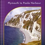 South West Coast Path 3 – Plymouth to Poole Harbour Harvey National Trail XT40
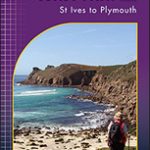 South West Coast Path 2 – St Ives to Plymouth Harvey National Trail XT40
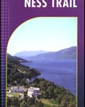 South Loch Ness Trail Harvey National Trail XT40
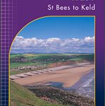 Coast to Coast West – St Bees to Keld Harvey National Trail XT40
 Cumbria Way Harvey National Trail XT40
 Two Moors Way Harvey National Trail XT40
 Ridgeway Harvey National Trail XT40
Cleveland Way Harvey National Trail XT40
Ridgeway Harvey National Trail XT40
Cleveland Way Harvey National Trail XT40
 Pembrokeshire Coast Path Harvey National Trail XT40
 Rob Roy Way Harvey National Trail XT40
Cotswold Way Harvey National Trail XT40
Rob Roy Way Harvey National Trail XT40
Cotswold Way Harvey National Trail XT40
 Glyndwr`s Way Harvey National Trail XT40
 Affric Kintail Way Harvey National Trail XT40
 South Downs Way Harvey National Trail XT40
 Cape Wrath Trail North – Strathcarron to Cape Wrath Harvey National Trail XT40
 St Cuthbert`s Way Harvey National Trail XT40
 Shropshire Way Harvey National Trail XT40
Speyside Way Harvey National Trail XT40
Shropshire Way Harvey National Trail XT40
Speyside Way Harvey National Trail XT40
 The Great Trossachs Path Harvey National Trail XT40
 Dales Way Harvey National Trail XT40
 Northumberland Coast Path & Berwickshire Coastal Path Harvey National Trail XT40
 Hadrian`s Wall Path Harvey National Trail XT40
 North Downs Way Harvey National Trail XT40
 Pennine Way South Harvey XT40 National Trail Map
 St Oswald`s Way Harvey National Trail XT40
 Settle to Carlisle Way Harvey National Trail XT40
 Skye Trail Harvey National Trail XT40
 Pennine Bridleway South Harvey XT40 National Trail Map
 John O`Groats Trail Harvey National Trail XT40
 Southern Upland Way Harvey National Trail XT40
 Coast to Coast – St Bees to Robin Hood’s Bay Harvey XT40 National Trail Map
 Pennine Bridleway Harvey XT40 National Trail Map
 Offa`s Dyke Path Harvey National Trail XT40
 Pennine Way North Harvey XT40 National Trail Map
Yorkshire Dales South West Harvey Ultramap XT40
Pennine Way North Harvey XT40 National Trail Map
Yorkshire Dales South West Harvey Ultramap XT40