Disclosure : This site contains affiliate links to products. We may receive a commission for purchases made through these links.
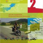
West Flanders Province
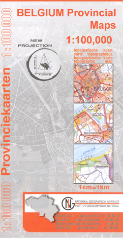
West Flanders Province on a double-sided map at 1:100,000 in a series of GPS compatible topographic maps from the Nationaal Geografisch Instituut/Institut Gรฉographique National, Belgium`s national survey organization, each with a separate index booklet covering the whole country.Described by the publishers as a topographic series, the maps do carry all the information expected of topographic mapping at this scale, but are not contoured and show altitude only by spot heights. Colours and graphics present the terrain and land cover: rocks, dunes, moors and heathland, orchards, woodlands, swamps and marshland, etc. Road network is finely graded according to width and the number of lanes. Footpaths are marked, but the maps do not distinguish between waymarked hiking paths or long-distance GR routes and other local paths. The maps also indicate administrative subdivisions of the provinces into districts and communes.The maps have latitude and longitude lines at intervals of 5’. Titles covering larger provinces are double-sided. The index booklet supplied with each map covers the whole country and, where appropriate, list alternative versions of place names. Map legend and explanatory text in the booklet include English.

Related Products:
 East Flanders Province
Luxembourg Province
Limburg (B) Province
Hainaut Province
Namur Province
Antwerp Province
Liรจge Province
Belgium: 100K Provincial Survey Maps
Brabant Provinces (Flemish and Wallon) and Brussels Region
East Flanders Province
Luxembourg Province
Limburg (B) Province
Hainaut Province
Namur Province
Antwerp Province
Liรจge Province
Belgium: 100K Provincial Survey Maps
Brabant Provinces (Flemish and Wallon) and Brussels Region
 Westhoek – South-West Flanders Falkplan Cycling Map 34
 Dutch Flanders – Ghent
 East Flanders: Kortrijk – Ninove
 French Flanders: Dunkerque – St. Omer – Ypres
 Delta South: Middelburg – Dutch Flanders
 Zeeland Islands with Zeelandic Flanders Falkplan Cycling Map 16
 Zeelandic Flanders – Meetjesland and Waasland Falkplan Cycling Map 31
Netherland & Flanders: Falk 50K Cycling Maps
Zeelandic Flanders – Meetjesland and Waasland Falkplan Cycling Map 31
Netherland & Flanders: Falk 50K Cycling Maps
 Lake Constance West
 West Virginia Easy to Fold Rand McNally
 East and West Flanders Cycling Map 1
 Malaysia F&B
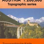 Austria: 200K Topographic Survey Province Maps
 Drenthe West Cycling Map
 West Frisian Islands Falkplan Cycling Map
Brabant West and Central Cycling Map
West Frisian Islands Falkplan Cycling Map
Brabant West and Central Cycling Map
 Spain – Portugal F&B
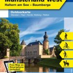 Hohe Mark / Mรผnsterland West 50K Kรผmmerly + Frey Map No. 60
 Eifel West – Schneifel 35K Kรผmmerly + Frey Map No. 34
 Lake Constance West – Konstanz – Radolfzell K+F Outdoor Map 43
 Harz West Kompass 451
 Sicily F&B Top 10 Tips
 Rheingau – West Taunus – Rรผdesheim – Wiesbaden K+F Outdoor Map 51
 Sardinia F&B Top 10 Tips
 Finland West Karttakeskus Road Map
 West Virginia Easy-to-Read Rand McNally
 Taunus West Kompass 839
 Belfast OSNI Street Plan
 Anglesey West – Holyhead OS Explorer Map 262 (paper)
South-Holland North – Green Heart West and Bollenstreek Falkplan Cycling Map 14
Anglesey West – Holyhead OS Explorer Map 262 (paper)
South-Holland North – Green Heart West and Bollenstreek Falkplan Cycling Map 14
 Anglesey West – Holyhead OS Explorer Active Map 262 (waterproof)