Disclosure : This site contains affiliate links to products. We may receive a commission for purchases made through these links.
West Bromwich 1902 – 68.10b
West Bromwich in 1902 in a fascinating series of reproductions of old Ordnance Survey plans in the Alan Godfrey Editions, ideal for anyone interested in the history of their neighbourhood or family. Two versions have been published for this area. The maps cover most of West Bromwich, stretching from Bond Street and St John`s church northward to West Bromwich Workhouse, and from Claypit Lane eastward to Dartmouth Park. Features on the 1886 version include the town centre, Christ Church, St Andrew`s church, Scale & Spring Balance Works, Town Hall, GWR railway with West Bromwich and Swan Village stations, part of Dartmouth Park, tramway, Guns Village area, Ireland Green Colliery; several disused collieries including Cordley, Cutlers End, Whyley, Tantany and Cronehills Collieries; Albion Bluebrick Works, Victoria Bluebrick Works, Albion football ground, Lyndon, Workhouse, etc. The 1886 version is in colour, taken from the beautiful hand-coloured 1st Edition.About the Alan Godfrey Editions of the 25″ OS Series:Selected towns in Great Britain and Ireland are covered by maps showing the extent of urban development in the last decades of the 19th and early 20th century. The plans have been taken from the Ordnance Survey mapping and reprinted at about 15 inches to one mile (1:4,340). On the reverse most maps have historical notes and many also include extracts from contemporary directories. Most maps cover about one mile (1.6kms) north/south, one and a half miles (2.4kms) across; adjoining sheets can be combined to provide wider coverage.FOR MORE INFORMATION AND A COMPLETE LIST OF ALL AVAILABLE TITLES PLEASE CLICK ON THE SERIES LINK.

Related Products:
 West Bromwich (North) 1885 – 68.06a Coloured Edition
 Greets Green 1902
 Brades Village 1902 68.13a
 Ipswich South-West 1902
Worcester South-West 1902
Ipswich South-West 1902
Worcester South-West 1902
 West Bromwich 1938: Staffordshire Sheet 68.10d
 West Bromwich (North) 1938: Staffordshire Sheet 68.06D
Leicester North West 1902
Wednesbury 1902
Worcester North-West 1902
West Bromwich (North) 1938: Staffordshire Sheet 68.06D
Leicester North West 1902
Wednesbury 1902
Worcester North-West 1902
 Dudley West 1901
Bristol Fishponds 1902
Dudley West 1901
Bristol Fishponds 1902
 Warrington West 1905
Belfast (East) 1902 – 4.11
Ipswich 1902 – 75.11
Wolverhampton North West 1901
Dudley (West) 1881 – 67.15a Coloured Edition
Leicester South West 1902-1911
Warrington West 1905
Belfast (East) 1902 – 4.11
Ipswich 1902 – 75.11
Wolverhampton North West 1901
Dudley (West) 1881 – 67.15a Coloured Edition
Leicester South West 1902-1911
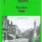 Taunton 1886 – Colour Edition
 Cannock South 1902
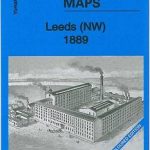 Leeds North West 1889 (Colour Edition)
 Great Bridge and Toll End 1902
North Tynedale 1902 – 13
Manchester North West and Central Salford 1915
Great Bridge and Toll End 1902
North Tynedale 1902 – 13
Manchester North West and Central Salford 1915
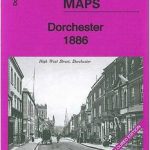 Dorchester 1886 – 40.15a Colour Edition
 Chelsea & West Brompton 1894 – 87.2
Bristol (St George) 1902 – 72.14
Langley and Londonderry 1902
Tenbury 1902
Swindon South-West 1899
Dundonald 1902
Halifax South West and Sowerby Bridge 1892
Belfast Bloomfield 1902
Maldon West 1920 – 55.16
Chelsea & West Brompton 1894 – 87.2
Bristol (St George) 1902 – 72.14
Langley and Londonderry 1902
Tenbury 1902
Swindon South-West 1899
Dundonald 1902
Halifax South West and Sowerby Bridge 1892
Belfast Bloomfield 1902
Maldon West 1920 – 55.16
 West Drayton South 1935
 Sheffield Hillsborough 1902
Birmingham Central 1902-1911
Bristol (SW) & Bedminster 1902 – 75.04a
Sheffield Hillsborough 1902
Birmingham Central 1902-1911
Bristol (SW) & Bedminster 1902 – 75.04a
 Sheffield Longley 1902
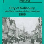 City of Salisbury with West Harnham & East Harnham 1900 – 66.15