Disclosure : This site contains affiliate links to products. We may receive a commission for purchases made through these links.
Categories
-
Best Sellers
-

Captains Courageous
When Harvey Cheyne, the precocious and arrogant son of an American railway tycoon, is rescused from drowning by a New England fishing boat, he is unable Read More » -

Lefkada Terrain Editions 351
Lefkada (Lefkas) and the nearby Meghanisi at 1:40,000 on a contoured, GPS compatible hiking map published by Terrain Cartography group together with Skai Maps, and printed Read More » -

Herbarium
Herbarium explores the histories, associations and uses of 100 herbs, as well as providing ideas for both food and wellbeing. Each entry features a specially commissioned Read More » -
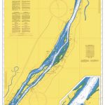
Admiralty Chart 4791 – Sorel to Varennes
NEW EDITION OUT 03/10/2019Admiralty standard nautical charts comply with Safety of Life at Sea (SOLAS) regulations and are ideal for professional, commercial and recreational use. Charts Read More » -

Leeuwarden
-

Long Circular Walks in the North Hills of the Chilterns
-

Peekaboo Wild
Illustrated in the same style as the popular app Peekaboo Barn, this board book introduces young readers to five different habitats: savannah, bamboo forest, jungle, the Read More » -
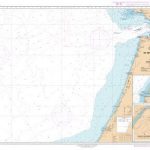
SHOM Chart 7550 – Du Dรฉtroit de Gibraltar ร Kenitra
PLEASE NOTE: the chart will be ordered for you if not currently in stock. Please allow 1-2 weeks for the chart to reach Stanfords. SHOM charts Read More » -

Laruns – Gourette – Col d`Aubisque – Vallee d`Ossau IGN 1546ET
Topographic survey of France at 1:25,000 in IGN`s excellent TOP25 / Sรฉrie Bleue series. All the maps are GPS compatible, with a 1km UTM grid plus Read More » -
CHS Chart 5348 – Approaches to Hopes Advance Bay
The official Canadian charts provide an excellent range of scales for the whole length of Canada`s coastline as well as the Grat Lakes and comply with Read More »
-


