Disclosure : This site contains affiliate links to products. We may receive a commission for purchases made through these links.
Wednesbury 1902
Wednesbury in 1902 in a fascinating series of reproductions of old Ordnance Survey plans in the Alan Godfrey Editions, ideal for anyone interested in the history of their neighbourhood or family. The map covers the Black Country town of Wednesbury, together with the industrial hinterland to its west, with the site of many disused collieries. Coverage stretches from the town centre and Market Place westward to Gospel Oak Road, and from Bilston Road southward to Ocker Hill Road. Features include the town centre, tramways, St Peter`s church, St John`s church, St Bartholomew`s church, Monway Collieries (disused), Walsall Canal, Monway Branch canal, Willingsworth Collieries (disused), Gosepel Oak area, Moorcroft Old Colliery, Doe Bank area, GWR railway with Wednesbury station and goods station, Brunswick Sidings, LNWR Princes End Branch with Ocker Hill station, LNWR South Staffordshire Line with Wednesbury station an stretch of Darlaston Branch, several large factories, etc. On the reverse are extracts from a 1901 directory. About the Alan Godfrey Editions of the 25″ OS Series:Selected towns in Great Britain and Ireland are covered by maps showing the extent of urban development in the last decades of the 19th and early 20th century. The plans have been taken from the Ordnance Survey mapping and reprinted at about 15 inches to one mile (1:4,340). On the reverse most maps have historical notes and many also include extracts from contemporary directories. Most maps cover about one mile (1.6kms) north/south, one and a half miles (2.4kms) across; adjoining sheets can be combined to provide wider coverage.FOR MORE INFORMATION AND A COMPLETE LIST OF ALL AVAILABLE TITLES PLEASE CLICK ON THE SERIES LINK.

Related Products:
 Great Bridge and Toll End 1902
 Greets Green 1902
 Gravelly Hill 1902
 Cannock South 1902
 Brades Village 1902 68.13a
 Bootle 1907
Bristol (St George) 1902 – 72.14
West Bromwich 1902 – 68.10b
Worcester North-East 1902
Birmingham Central 1902-1911
Bristol (NE) 1902 – 72.13a
Bootle 1907
Bristol (St George) 1902 – 72.14
West Bromwich 1902 – 68.10b
Worcester North-East 1902
Birmingham Central 1902-1911
Bristol (NE) 1902 – 72.13a
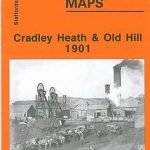 Cradley Heath and Old Hill 1901
Langley and Londonderry 1902
Ipswich 1902 – 75.11
Cradley Heath and Old Hill 1901
Langley and Londonderry 1902
Ipswich 1902 – 75.11
 Tipton 1904
Ipswich South-West 1902
Darlaston & King`s Hill 1901
Tipton 1904
Ipswich South-West 1902
Darlaston & King`s Hill 1901
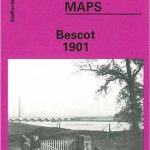 Bescot 1901
Birmingham North 1913
Belfast Knockdene Park 1902
Sydenham and Strandtown 1902
Swindon South-West 1899
Swindon South-East 1899
Swindon (NW) 1899 – 15.03a
Swindon (NE) 1899 – 15.04a
Bescot 1901
Birmingham North 1913
Belfast Knockdene Park 1902
Sydenham and Strandtown 1902
Swindon South-West 1899
Swindon South-East 1899
Swindon (NW) 1899 – 15.03a
Swindon (NE) 1899 – 15.04a
 Walsall (SW) & Pleck 1901 – 63.10a
 Mesty Croft 1888
North Tynedale 1902 – 13
Mesty Croft 1888
North Tynedale 1902 – 13
 Wirksworth 1920
Leicester North West 1902
Wirksworth 1920
Leicester North West 1902
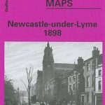 Newcastle-under-Lyme 1898 – 17.04b
Worcester South-East 1902
Rowley Regis and Blackheath 1902
Belfast Bloomfield 1902
Westhoughton 1907
Moss Valley and Gwersyllt 1909
Wincobank & Meadowhall 1902 – 289.13a
Leicester (NE) 1913 – 31.11
Leicester South West 1902-1911
Loughborough 1901
Newcastle-under-Lyme 1898 – 17.04b
Worcester South-East 1902
Rowley Regis and Blackheath 1902
Belfast Bloomfield 1902
Westhoughton 1907
Moss Valley and Gwersyllt 1909
Wincobank & Meadowhall 1902 – 289.13a
Leicester (NE) 1913 – 31.11
Leicester South West 1902-1911
Loughborough 1901