Disclosure : This site contains affiliate links to products. We may receive a commission for purchases made through these links.
Watsonville – Santa Cruz – Scotts Valley CA
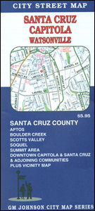
Santa Cruz – Capitola – Watsonville area of California in a series of indexed street plans of US cities from G.M. Johnson and Associates. Five separate panels: Palm Beach, Watsonville, Santa Cruz (with additional insets for downtown Santa Cruz and Capitola), Davenport and Summit Area provide between them continuous coverage of most of the Santa Cruz County. On the reverse is a road map of the whole county indicating which areas are shown on panels. Street plans from G.M. Johnson and Associates are indexed and show longer streets annotated with block numbers for easier identification of addresses. Administrative boundaries are marked but not zip code areas. Colours indicate shopping centres, university areas, parks and adjoining protected areas such as national or state forest, etc.

Related Products:
 Santa Barbara – Carpinteria – Santa Maria CA
 Bakersfield, Kern County, CA
 Farmington, NM – Durango, CO – Cortez, CO
 Taos – Espanola – Los Alamos, NM
 Santa Cruz de Moya CNIG Topo 637-2
Santa Cruz de Montes CNIG Topo 159-4
Santa Cruz de Moya CNIG Topo 637-2
Santa Cruz de Montes CNIG Topo 159-4
 Santa Cruz de Tenerife CNIG Topo 1089
Santa Cruz de la Palma CNIG Topo 1085
Santa Cruz da Graciosa – Azores 21
Santa Cruz de Tenerife CNIG Topo 1089
Santa Cruz de la Palma CNIG Topo 1085
Santa Cruz da Graciosa – Azores 21
 Santa Cruz Noir
 Big Basin – Santa Cruz Parks and Preserves CA
 Santa Cruz de Tenerife CNIG Topo 1088-4/1089-3
Santa Cruz de La Palma 25K CNIG Topographic Survey Map No. 1085-II
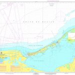
SEMAR Chart 622.5 – Santa Cruz, Huatulco
Santa Cruz de Tenerife CNIG Topo 1088-4/1089-3
Santa Cruz de La Palma 25K CNIG Topographic Survey Map No. 1085-II
SEMAR Chart 622.5 – Santa Cruz, Huatulco
 SHOM Chart 7429 – Puerto de Santa Cruz de Tรฉnรฉrife
 NOAA Chart 18728 – Santa Cruz Channel
Santa Cruz de Mudela CNIG Topo 838
NOAA Chart 18728 – Santa Cruz Channel
Santa Cruz de Mudela CNIG Topo 838
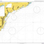 Admiralty Chart 1847 – Santa Cruz de Tenerife
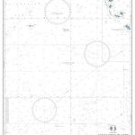 Admiralty Chart 4624 – Santa Cruz Islands to Butaritari
 NOAA Chart 18721 – Santa Cruz Island to Purisima Point
 Moon Monterey & Carmel Handbook – Including Santa Cruz & Big Sur
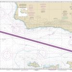
 Admiralty Chart 3335 – Puerto Santa Cruz to Estrecho to Magallanes
 Santa Cruz de Tenerife Province 200K CNIG Map No. 38
 Chattanooga – Knoxville – Sevier County TN Rand McNally
 Admiralty Chart 539 – Puerto Santa Cruz to Cabo Pilar including the Falkland Islands
 SEMAR Chart 842 – Laguna Pom a Santa Cruz
SEMAR Chart 414.3 – San Blas to Santa Cruz
SEMAR Chart 842 – Laguna Pom a Santa Cruz
SEMAR Chart 414.3 – San Blas to Santa Cruz
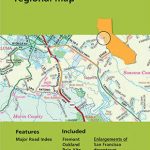 San Francisco Bay Area CA Regional Rand McNally
Admiralty Chart 4913 – Cape San Martin to Santa Cruz
San Francisco Bay Area CA Regional Rand McNally
Admiralty Chart 4913 – Cape San Martin to Santa Cruz
 NOAA Chart 18685 – Monterey Bay – Monterey Harbor – Moss Landing Harbor – Santa Cruz Small Craft Harbor
 Admiralty Chart 3334 – Puerto Deseado To Puerto Santa Cruz
 Manhattan Block-by-Block Street Atlas
 Jacksonville FL Rand McNally
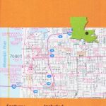 Baton Rouge LA Rand McNally
 Syracuse NY Rand McNally
 Birmingham AL Rand McNally
 Anchorage – Fairbanks – Juneau – Ketchikan AK Rand McNally
 Atlanta GA Regional Rand McNally
 Fort Worth TX Rand McNally
 Colorado Springs CO Rand McNally