Disclosure : This site contains affiliate links to products. We may receive a commission for purchases made through these links.
Waterway Guide

Related Products:
 Waterway Guide Atlantic Intercoastal Waterway (ICW) 2021
 Waterway Guide Chesapeake Bay 2021
 Waterway Guide Southern 2021
 Waterway Guide Bahamas 2021
 Waterway Guide Cuba – Edition 2
 Waterway Guide Florida Keys – 3rd Edition
 Waterway Guide Western Gulf Coast 2021
 Waterway Guide Northern 2021 – Cape May, NJ to Eastport, ME including the Hudson River
 Waterway Guide Great Lakes 2021 – Volume 1 – Eastern Great Lakes
 Waterway Guide Great Lakes 2021 – Volume 2 – Western Great Lakes
 Allagash Wilderness Waterway South ME
 Milford Haven: Waterway and Town
 The Channel: The Remarkable Men and Women Who Made It the Most Fascinating Waterway in the World
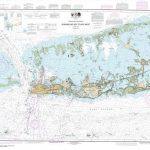 NOAA Chart 11446 – Intracoastal Waterway’”Sugarloaf Key to Key West
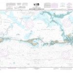 NOAA Chart 11449 – Intracoastal Waterway’”Matecumbe to Grassy Key
 NOAA Chart 11465 – Intracoastal Waterway’”Miami to Elliott Key
 NOAA Chart 11367 – Intracoastal Waterway’”Waveland to Catahoula Bay
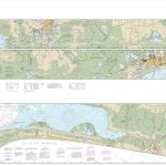 NOAA Chart 11331 – Intracoastal Waterway – Ellender to Galveston Bay
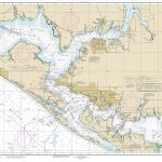 NOAA Chart 11390 – Intracoastal Waterway’”East Bay to West Bay
 CEN309E Trent-Severn Waterway, 2016 – CHS Sailing Directions
 NOAA Chart 11411 – Intracoastal Waterway’”Tampa Bay to Port Richey
 NOAA Chart 11425 – Intracoastal Waterway’”Charlotte Harbor to Tampa Bay
 NOAA Chart 11445 – Intracoastal Waterway’”Bahia Honda Key to Sugarloaf Key
 NOAA Chart 11448 – Intracoastal Waterway’”Big Spanish Channel to Johnston Key
 NOAA Chart 11453 – Intracoastal Waterway’”Grassy Key to Bahia Honda Key
 NOAA Chart 11464 – Intracoastal Waterway’”Blackwater Sound to Matecumbe
 NOAA Chart 12324 – Intracoastal Waterway’”Sandy Hook to Little Egg Harbor
 NOAA Chart 18450 – Seattle Harbor’”Elliott Bay and Duwamish Waterway
 NOAA Chart 11372 – Intracoastal Waterway’”Dog Keys Pass to Waveland
 NOAA Chart 11308 – Intracoastal Waterway’”Redfish Bay to Middle Ground
 NOAA Chart 11322 – Intracoastal Waterway – Galveston Bay to Cedar Lakes
 NOAA Chart 11393 – Intracoastal Waterway’”Lake Wimico to East Bay
 NOAA Chart 11402 – Intracoastal Waterway’”Apalachicola Bay to Lake Wimico
 NOAA Chart 11463 – Intracoastal Waterway’”Sands Key to Blackwater Sound
 NOAA Chart 11489 – Intracoastal Waterway’”St. Simon Sound to Tolomato River
 NOAA Chart 11467 – Intracoastal Waterway’”West Palm Beach to Miami
 NOAA Chart 11485 – Intracoastal Waterway’”Tolomato River to Palm Shores
 NOAA Chart 11314 – Intracoastal Waterway’”Carlos Bay to Redfish Bay, including Copano Bay
 NOAA Chart 11319 – Intracoastal Waterway’”Cedar Lakes to Espiritu Santo Bay
 NOAA Chart 11385 – Intracoastal Waterway’”West Bay to Santa Rosa Sound


