Disclosure : This site contains affiliate links to products. We may receive a commission for purchases made through these links.
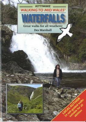
Walking to Mid Wales Waterfalls

Related Products:
 Walking Mid Wales` Nature Reserves
 Wales Hill Walking – Volume 1 – Arans – Dovey Hills
 Wales Hill Walking – Volume 2 – Ffestiniog Hills – Tarrens
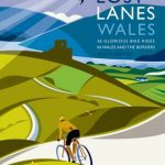 Lost Lanes Wales: 36 Glorious Bike Rides in Wales and the Borders
 Vermont Waterfalls
 Coast Wales – Pocket Wales
 Landscape Wales – Pocket Wales
 Mountain Wales – Pocket Wales
 Wales Coast Path Official Guide 7: South Wales Coast: Swansea to Chepstow
 Moon Sequoia & Kings Canyon (First Edition): Hiking, Camping, Waterfalls & Big Trees
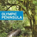 Moon Olympic Peninsula (Fourth Edition): Coastal Getaways, Rainforests & Waterfalls, Hiking & Camping
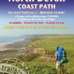 Exmoor & North Devon Coast Path, South-West-Coast Path Part 1: Minehead to Bude (Trailblazer British Walking Guide): Practical walking guide with 55 large-scale walking maps (1:20,000) and guides to 30 towns and villages – planning, places to stay, places
 Wales Collins Pocket Map – The perfect way to explore Wales
 Walking Brooklyn: 30 walking tours exploring historical legacies, neighborhood culture, side streets, and waterways
 England & Wales Island Bagging: A guide to adventures on the islands of England, Wales, the Channel Islands & the Isle of Man
 Lake District – Walks to Waterfalls
 Yorkshire Dales – Walks to Waterfalls
 Wild Swimming France: Discover the Most Beautiful Rivers, Lakes and Waterfalls of France
 Wild Swimming Britain: 300 Hidden Dips in the Rivers, Lakes and Waterfalls of Britain
 Wild Swimming Italy – Discover the Most Beautiful Rivers, Lakes and Waterfalls of Italy
 Wild Swimming Spain: Discover the Most Beautiful Rivers, Lakes and Waterfalls of Spain
 Take the Slow Road: England and Wales: Inspirational Journeys Round England and Wales by Camper Van and Motorhome
 The Rocks of Wales – BGS Geological Map of Wales
 The Mountains of England and Wales: Vol. 1 – Wales
 North Wales – Lon Eifion – Lon Las Cefni – North Wales Coast Route Sustrans Cycle Map 24
 Wales Coast Path Official Guide 1: North Wales Coast: Chester to Bangor
 Walking St. Cuthbert`s Wayfrom Melrose to Lindisfarne: My Story of Walking the 72 mileSt. Cuthbert`s Way
 North Wales Coast – Chester to Bangor – Wales Coast Path Map-Booklet
 Wild Swimming France: 750 most beautiful rivers, lakes, waterfalls & natural pools
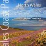 North Wales Coast: Circular Walks Along the Wales Coast Path
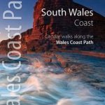 South Wales Coast: Circular Walks Along the Wales Coast Path
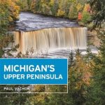 Moon Michigan`s Upper Peninsula (Fifth Edition): Scenic Drives, Waterfalls, Lakeside Getaways
 South Downs Way (Trailblazer British Walking Guides): Practical guide with 60 Large-Scale Walking Maps (1:20,000) & Guides to 49 Towns & Villages – Planning, Places To Stay, Places to Eat: 2022
 Coast to Coast Path (Trailblazer British Walking Guide): 109 Large-Scale Walking Maps & Guides to 33 Towns & Villages – Planning, Places to Stay, Places to Eat – St Bees to Robin Hood`s Bay
 Walking in the Brianconnais: 40 walking routes in the French Alps exploring high mountain landscapes near Briancon
 Walking and Trekking in Zagori: Walking routes in Greece`s wild and beautiful northern Pindos mountains
 Iceland, Walking and Trekking – 100 days of walking and multi-day treks
 Walking in County Durham: 40 walking routes exploring Pennine moors, river valleys and coastal paths
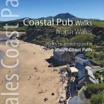 Coastal Pub Walks: North Wales: Walks to amazing coastal pubs on the Wales Coast Path
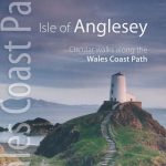 Wales Coast Path: Isle of Anglesey – Circular walks along the Wales Coast Path