Disclosure : This site contains affiliate links to products. We may receive a commission for purchases made through these links.
Walensee – Toggenburg East K+F Hiking Map 15

These laminated hiking maps at a scale of 1:40 000 are the ideal basis for planning a hiking tour.The precise cartography shows hiking trails including classification. Information on accommodation and restaurants, bus routes with stops, mountain railways, regional parks, sights and much more are included on the map.Thanks to the quality of the tear-proof and weather-resistant paper, the map will be a faithful companion everywhere. GPS compatible, 25 meter interval contour lines.

Related Products:
 Rapperswil-Jona – Toggenburg West K+F Hiking Map 14
Lake Constance East K+F Hiking Map 03
Rapperswil-Jona – Toggenburg West K+F Hiking Map 14
Lake Constance East K+F Hiking Map 03
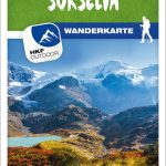 Andermatt – Surselva K+F Hiking Map 33
Silvaplana – Bergell K+F Hiking Map 46
Andermatt – Surselva K+F Hiking Map 33
Silvaplana – Bergell K+F Hiking Map 46
 Zermatt – Saas-Fee K+F Hiking Map 49
Grรคchen – Leukerbad – Lรถtschental K+F Hiking Map 41
Aargau Ost – Lenzburg – Baden K+F Hiking Map 07
Zermatt – Saas-Fee K+F Hiking Map 49
Grรคchen – Leukerbad – Lรถtschental K+F Hiking Map 41
Aargau Ost – Lenzburg – Baden K+F Hiking Map 07
 Appenzell – Santis – St. Gallen K+F Hiking Map 09
 Thunersee – Adelboden – Kandersteg K+F Hiking Map 30
Simplon – Aletsch – Goms K+F Hiking Map 42
Thunersee – Adelboden – Kandersteg K+F Hiking Map 30
Simplon – Aletsch – Goms K+F Hiking Map 42
 Locarno – Maggia – Verzasca K+F Hiking Map 44
 Lugano – Sottoceneri – Gambarogno K+F Hiking Map 50
 Jura – Ajoie K+F Hiking Map 04
Solothurn – Oberaargau K+F Hiking Map 11
Schwyz – Glarus – Muotathal – Klรถntal K+F Hiking Map 21
Flims – Laax – Lumnezia – Splรผgen K+F Hiking Map 34
Sarganserland – Sardona – Pizol – Chur K+F Hiking Map 22
Hasliberg – Grimsel – Obergoms – Titlis K+F Hiking Map 32
Leventina – Gotthard – Valle di Blenio K+F Hiking Map 43
Nyon-Genรจve / La Dรดle K+F Hiking Map 38
Prรคttigau – Klosters – Silvretta K+F Hiking Map 23
Jura – Ajoie K+F Hiking Map 04
Solothurn – Oberaargau K+F Hiking Map 11
Schwyz – Glarus – Muotathal – Klรถntal K+F Hiking Map 21
Flims – Laax – Lumnezia – Splรผgen K+F Hiking Map 34
Sarganserland – Sardona – Pizol – Chur K+F Hiking Map 22
Hasliberg – Grimsel – Obergoms – Titlis K+F Hiking Map 32
Leventina – Gotthard – Valle di Blenio K+F Hiking Map 43
Nyon-Genรจve / La Dรดle K+F Hiking Map 38
Prรคttigau – Klosters – Silvretta K+F Hiking Map 23
 Basel – Solothurner Jura K+F Hiking Map 05
Zurich Unterland – Winterthur K+F Hiking Map 08
Lucerne – Willisau – Sursee K+F Hiking Map 12
Bern – Schwarzenburg – Aaretal K+F Hiking Map 18
Yverdon-les-Bains – Lausanne K+F Hiking Map 26
Basel – Solothurner Jura K+F Hiking Map 05
Zurich Unterland – Winterthur K+F Hiking Map 08
Lucerne – Willisau – Sursee K+F Hiking Map 12
Bern – Schwarzenburg – Aaretal K+F Hiking Map 18
Yverdon-les-Bains – Lausanne K+F Hiking Map 26
 Jungfrau Region – Brienzersee K+F Hiking Map 31
Grand-St-Bernard – Verbier K+F Hiking Map 48
Murten – Neuchรขtel – Freiburg K+F Hiking Map 17
Jungfrau Region – Brienzersee K+F Hiking Map 31
Grand-St-Bernard – Verbier K+F Hiking Map 48
Murten – Neuchรขtel – Freiburg K+F Hiking Map 17
 Unterengadin / Lower Engadine – Scuol – Samnaun K+F Hiking Map 24
 Davos – St. Moritz – Oberengadin / Upper Engadine K+F Hiking Map 36
Molรฉson – Romont – Lavaux – Gruyรจre K+F Hiking Map 27
Lake Constance West – Thurgau K+F Hiking Map 02
Aargau West – Olten – Aarau K+F Hiking Map 06
Lake Zurich – Lake Zug K+F Hiking Map 13
Regional Park Gruyรจre Pays-d`Enhaut K+F Hiking Map
Davos – St. Moritz – Oberengadin / Upper Engadine K+F Hiking Map 36
Molรฉson – Romont – Lavaux – Gruyรจre K+F Hiking Map 27
Lake Constance West – Thurgau K+F Hiking Map 02
Aargau West – Olten – Aarau K+F Hiking Map 06
Lake Zurich – Lake Zug K+F Hiking Map 13
Regional Park Gruyรจre Pays-d`Enhaut K+F Hiking Map
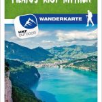 Lake Lucerne – Pilatus-Rigi-Mythen K+F Hiking Map 20
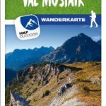 Nationalpark – Val Mustair K+F Hiking Map 37
Bellinzona – San Bernardino K+F Hiking Map 45
Nationalpark – Val Mustair K+F Hiking Map 37
Bellinzona – San Bernardino K+F Hiking Map 45
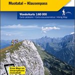 Glarnerland – Walensee – Muotatal – Klausenpass 60K K+F Hiking Map No. 12