Disclosure : This site contains affiliate links to products. We may receive a commission for purchases made through these links.
Wakefield (South) 1890 – 248.07a

Wakefield South in 1890 in a fascinating series of reproductions of old Ordnance Survey plans in the Alan Godfrey Editions, ideal for anyone interested in the history of their neighbourhood or family. The map covers the southern part of Wakefield, stretching from George Street southward to Sparable Lane. Several railways cross the map with Kirkgate station and engine shed. Features include the River Calder with piers, Aire & Calder Navigation, Calder Mills, Providence Terrace, malthouses, Rutland Mills, Old Bridge Brewery, Fall Ings, Calder Vale, Grove Iron Works, New Wells, Primrose Hill, chemical works, Belle Vue, St Catherine`s church, Wakefield Trinity football ground, cemetery, cattle market, part of Westgate, Eagle Brewery. Part of Thornes village is in the south-western quarter, including St James church, Bishop Blaize Inn, Lowe Hill, etc. An extensive selection of street directory entries is on the reverse, including George Street, Ings Road, Kirkgate, Southgate and Thornes Road.About the Alan Godfrey Editions of the 25″ OS Series:Selected towns in Great Britain and Ireland are covered by maps showing the extent of urban development in the last decades of the 19th and early 20th century. The plans have been taken from the Ordnance Survey mapping and reprinted at about 15 inches to one mile (1:4,340). On the reverse most maps have historical notes and many also include extracts from contemporary directories. Most maps cover about one mile (1.6kms) north/south, one and a half miles (2.4kms) across; adjoining sheets can be combined to provide wider coverage.FOR MORE INFORMATION AND A COMPLETE LIST OF ALL AVAILABLE TITLES PLEASE CLICK ON THE SERIES LINK.

Related Products:
 Wakefield (North) 1890 – 248.03a
 Leeds South and South East 1890 (Colour Edition)
Wakefield West 1905
Leeds South and South East 1890 (Colour Edition)
Wakefield West 1905
 Leeds South and South East 1906
Leeds Central and North East 1890
Leeds South and South East 1906
Leeds Central and North East 1890
 Derby (South) 1899 – 50.13a
 Huddersfield South 1905
Wath upon Dearne 1901
Huddersfield South 1905
Wath upon Dearne 1901
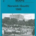 Norwich (South) 1905 – 63.15
 Walsall (SE) 1901 – 63.11
Ipswich South-West 1902
Smethwick 1901 – 72.03a
South Yardley and Hay Mills 1903
Bristol (St George) 1902 – 72.14
Birmingham South 1913
Ossett Central 1890
Walsall (SE) 1901 – 63.11
Ipswich South-West 1902
Smethwick 1901 – 72.03a
South Yardley and Hay Mills 1903
Bristol (St George) 1902 – 72.14
Birmingham South 1913
Ossett Central 1890
 Wakefield (South) 1913 – 248.07b
South Bank and Grangetown North 1927
Horbury 1905
Trafford Park South 1937
South Shields 1895
Birmingham North 1913
Worcester South-East 1902
South Oxford 1898 – 39.03
Wakefield (South) 1913 – 248.07b
South Bank and Grangetown North 1927
Horbury 1905
Trafford Park South 1937
South Shields 1895
Birmingham North 1913
Worcester South-East 1902
South Oxford 1898 – 39.03
 Stoke upon Trent (South) 1898 – 18.05
Doncaster South 1928 – 285.01b
Barnsley South 1904
Halifax South West and Sowerby Bridge 1892
Luton 1922 – 33.05
Stoke upon Trent (South) 1898 – 18.05
Doncaster South 1928 – 285.01b
Barnsley South 1904
Halifax South West and Sowerby Bridge 1892
Luton 1922 – 33.05
 South Croydon 1895 – 14.14
 South Croydon 1895 – 159.2
Swindon South-West 1899
Swindon South-East 1899
Manchester South-East 1915
South Croydon 1895 – 159.2
Swindon South-West 1899
Swindon South-East 1899
Manchester South-East 1915
 Workington South 1923
 South Acton & Gunnersbury Park 1935 – 71.4
Central Liverpool 1890 – 106.14a Colour Edition
Carlisle South-West 1924
Stourbridge South and Oldswinford 1914
Wrexham Central 1909
South Acton & Gunnersbury Park 1935 – 71.4
Central Liverpool 1890 – 106.14a Colour Edition
Carlisle South-West 1924
Stourbridge South and Oldswinford 1914
Wrexham Central 1909