Disclosure : This site contains affiliate links to products. We may receive a commission for purchases made through these links.
Wakefield (North) 1890 – 248.03a

Wakefield North in 1890 in a fascinating series of reproductions of old Ordnance Survey plans in the Alan Godfrey Editions, ideal for anyone interested in the history of their neighbourhood or family. The map covers the northern part of Wakefield and features include the Cathedral, Borough Market, St Andrew`s church, Westgate station, Prison (left blank for security reasons), St Johns Ward, Northgate Ward, West Riding Lunatic Asylum, St John`s Grove, East Moor, Westfield Grove, Newton, St John`s Mill, Wrenthorpe Colliery with railway line, Clark Hall, etc. On the reverse is an extensive selection of street directory entries, including Borough Market, Butcher Row, Northgate, Old Market Place, Stanley Road, Westgate and Wood Street.About the Alan Godfrey Editions of the 25″ OS Series:Selected towns in Great Britain and Ireland are covered by maps showing the extent of urban development in the last decades of the 19th and early 20th century. The plans have been taken from the Ordnance Survey mapping and reprinted at about 15 inches to one mile (1:4,340). On the reverse most maps have historical notes and many also include extracts from contemporary directories. Most maps cover about one mile (1.6kms) north/south, one and a half miles (2.4kms) across; adjoining sheets can be combined to provide wider coverage.FOR MORE INFORMATION AND A COMPLETE LIST OF ALL AVAILABLE TITLES PLEASE CLICK ON THE SERIES LINK.

Related Products:
 Wakefield (South) 1890 – 248.07a
Wakefield West 1905
Wakefield (South) 1890 – 248.07a
Wakefield West 1905
 Leeds Central and North East 1890
Devonport North 1893
North Shields and Chirton 1894
Ossett Central 1890
Leicester North West 1902
Central Liverpool 1890 – 106.14a Colour Edition
Norwich (North) 1905 – 63.11
Knutsford North 1908
Newcastle & Gateshead 1914 – 18b
Newcastle & Gateshead 1894 – 18a
Leeds Central and North East 1890
Devonport North 1893
North Shields and Chirton 1894
Ossett Central 1890
Leicester North West 1902
Central Liverpool 1890 – 106.14a Colour Edition
Norwich (North) 1905 – 63.11
Knutsford North 1908
Newcastle & Gateshead 1914 – 18b
Newcastle & Gateshead 1894 – 18a
 Liverpool North 1906
Stockton (North) 1899 – 50.12a
Blackburn 1929
Hull West 1890 (Colour Edition)
Blackburn 1910
Carlisle North-East 1924
Liverpool North 1906
Stockton (North) 1899 – 50.12a
Blackburn 1929
Hull West 1890 (Colour Edition)
Blackburn 1910
Carlisle North-East 1924
 Cambridge (North) 1901 – 40.14
 Blackburn 1892 (Coloured Edition)
Birmingham North 1913
Plymouth North 1893
Blackburn 1892 (Coloured Edition)
Birmingham North 1913
Plymouth North 1893
 Bromley North and Sundridge Park 1895
Blackpool North Pier & Town Centre 1910
Nottingham North 1913
Bromley North and Sundridge Park 1895
Blackpool North Pier & Town Centre 1910
Nottingham North 1913
 Beverley North 1908
Hull (East) 1890 – 240.03a Colour Edition
Manchester North West and Central Salford 1915
Beverley North 1908
Hull (East) 1890 – 240.03a Colour Edition
Manchester North West and Central Salford 1915
 Manchester: Ancoats North 1848
 Tottenham (North) 1894 – 8a
 Ebbw Vale North 1899
Leytonstone 1893 – 23.2
Hurst and North Ashton 1906
Ebbw Vale North 1899
Leytonstone 1893 – 23.2
Hurst and North Ashton 1906
 Evesham North 1903
Worcester North-West 1902
Evesham North 1903
Worcester North-West 1902
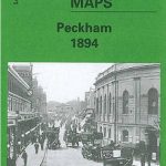 Peckham 1894 – 103.2
Northfield North 1903
Peckham 1894 – 103.2
Northfield North 1903
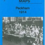 Peckham 1914 – 103.3
Peckham 1871 – 103.1
Peckham 1914 – 103.3
Peckham 1871 – 103.1
 Great Driffield 1909