Disclosure : This site contains affiliate links to products. We may receive a commission for purchases made through these links.
Vorarlberg – Tyrol K+F Road Map
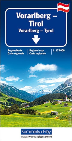
Tyrol and Vorarlberg provinces of Austria on an indexed, double-sided touring map at 1:175,000 from Hallwag Kรผmmerly + Frey, printed on durable, waterproof and tear-resistant synthetic paper. Coverage, with a generous overlap between the sides, extends from Lake Constance eastwards across the Austrian Alps to popular holiday resorts of Zell am See and Kaprun, the peaks of the Glockner massif and Lienz. North/south the map extends from the German Alps to Bressanone/Brixen in the Italian South Tyrol.Clear and easy to read road network highlights scenic roads and indicates motorway junction numbers and services, steep gradients and winter closures, roads not recommended to or closed to caravans, etc. Driving distances are marked on main and on most connecting local routes. Railway lines are shown with stations and include heritage tourist routes. Various places of interest are highlighted. The map also indicates campsites and youth hostels. Topography is presented by light, unobtrusive relief shading with plenty of names of mountain ranges, etc, plus colouring for woodlands and boundaries of national/natural parks. The map is indexed and has latitude and longitude lines at intervals of 10’. Map legend includes English.To see other maps in this series please click on the series link.

Related Products:
 Tyrol – Vorarlberg F&B
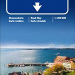
 Vorarlberg – Tyrol – Upper Bavaria – South Tyrol 200K Marco Polo Zoom Map
 Austria – Liechtenstein – South Tyrol Marco Polo Road Atlas
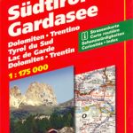
 South Tyrol – Dolomites Tabacco Road and Panorama Map
 South Tyrol – Bolzano F&B Top 10 Tips
 Tyrol F&B Top 10 Tips
 Zillertal Alps: Trekking and Peaks in the Austrian Tyrol and Italian South Tyrol
 Vorarlberg F&B Top 10 Tips
 South Tyrol – Lake Garda
Upper Bavaria – Tyrol – South Tyrol Motorcycle Map
South Tyrol – Lake Garda
Upper Bavaria – Tyrol – South Tyrol Motorcycle Map
 Tyrol – Dolomites Road and Panorama F&B
South Tyrol Cycling Map
Munich – South Tyrol – Upper Bavaria 3in1 Flash Guide
Tyrol – Dolomites Road and Panorama F&B
South Tyrol Cycling Map
Munich – South Tyrol – Upper Bavaria 3in1 Flash Guide
 South Tyrol Cycle Region Bikeline Map-Guide
Bavaria South – Munich – Upper Bavaria K+F Road Map 8
Italy: Tabacco 25K Maps of the Regional Parks in South Tyrol
South Tyrol Cycle Region Bikeline Map-Guide
Bavaria South – Munich – Upper Bavaria K+F Road Map 8
Italy: Tabacco 25K Maps of the Regional Parks in South Tyrol
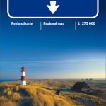
 Denmark South – Kolding – Copenhagen – Bornholm K+F Regional Road Map
 Austria F&B Road Map Set
 South Tyrol – Dolomites 4-Map Set Kompass 699
 South Tyrol – Lake Garda – Venice 3in1 Flash Guide
 South Tyrol – Trentino – Lake Garda – Veneto F&B
 Tyrol Mountain Bike Trail (1000km) Bikeline Atlas
 Italy North K+F Road Map
 Italy K+F Double-Sided Road Map
 Scotland North & South A-Z Road Map
Lake Constance F&B Leisure & Panorama
Scotland North & South A-Z Road Map
Lake Constance F&B Leisure & Panorama
 Bolzano Vignetei e Dolomiti / Southern South Tyrol Kompass 74
 Black Forest – Lake Constance K+F Road Map
 South Tyrol Wine Route – Unterland / Bassa Atesina Kompass 074
 Deep South USA 10 Hallwag Road Map
 East Tyrol Cycling Atlas
 South West England & South Wales A-Z Road Map
 North Sea Coast – Bremen – Hamburg K+F Regional Road Map
 Greater Munich F&B Top 10 Tips
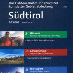 South Tyrol Kompass Hiking & Recreational Kompass Ring-binder Atlas No. 2703: Bormio – Merano – Bolzano – Cortina d`Ampezzo
 Bavaria North – Saxony – Thuringia K+F Regional Road Map
 Berlin – Brandenburg – Saxony-Anhalt K+F Regional Road Map
 Lake Constance F&B Touring Map