Disclosure : This site contains affiliate links to products. We may receive a commission for purchases made through these links.
Vltava

A5 size, 72-page guide-booklet for use in navigating the Vltava river between Borova Lada and Hluboka. The route is covered by 13 1:50,000 scale maps. All text is in Czech only, but the map legend includes English translation.Detail includes locks, bridges, distance indicators, water guages, marinas, rapids, danger points, facilities eg. hostels, grocers & campsites, as well as roads, landmarks and attractions. Lock and weir diagrams are also included.

Related Products:
 Bohemian Forest – Mรผhlviertel – Moldau/Vltava Reservoir Freytag & Berndt Map
 Stockholm County Norstedts Road Map
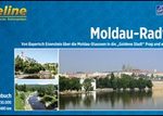 Vltava Cycle Route: ล umava National Park to Prague (480km) Bikeline Map/Guide
 River Medway: the Upper Reaches – Rochester to Tonbridge
 Las Vegas Borch
 Great Britain: Heron Canal Maps
 Great Britain: Inland Waterways` Maps
 Denmark K+F Road Map
 Bregenz F&B
 Monmouthshire and Brecon Canal – and Crumlin Arm Heron Map
 Tatra F&B Top 10 Tips
 France: Inland Waterways Map
 London Bridges SMALL
 Gerry Charnley Round in the Lakeland Fells
 Costa Rica F&B
 Chinese Bridges: Living Architecture from China`s Past
 Germany Insight Travel Map
 Brittany Marco Polo Map
 Burgenland F&B
 Carinthia F&B
 Arran – including Arran Coastal Way Harvey Ultramap XT40
 Serbia – Montenegro – Macedonia F&B
 Arran – incl. Arran Coastal Way Harvey Superwalker XT25 Map
 Styria F&B
 Lower Austria F&B
 Tyrol – Vorarlberg F&B
 Skye Trail Harvey National Trail XT40
 Glyndwr`s Way Harvey National Trail XT40
 Brecon Beacons Harvey British Mountain Map XT40
 Canada West Insight Travel Map
 Severn, Avon & Birmingham Collins Nicholson Waterways Guide 2
 Switzerland Insight Travel Map
 Great Glen Way Harvey National Trail XT40
 Salzburg State F&B
 Netherlands Insight Travel Map
 Upper Austria F&B
 Middle Dalmatian Coast 3 – Brac – Hvar – Split F&B
 Norway Insight Travel Map