Disclosure : This site contains affiliate links to products. We may receive a commission for purchases made through these links.
Vlasina Lake

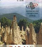
Vlasina Lake and its environs at 1:30,000 on a detailed, GPS compatible map from the Belgrade based Geokarta highlighting tourist facilities, with on the reverse extensive notes about the area in English. The map is centred on the lake and shows locations of campsites and other tourist accommodation. Local roads indicate locations of petrol stations.Topography of the area is shown by contours 10m intervals. Boundary of the protected area around the late is marked. All place names are in the Latin alphabet only. The map has latitude and longitude lines at intervals of 5’.On the reverse are extensive notes about various aspects of the area illustrated with colour photos.Map legend and all the text include English.


