Disclosure : This site contains affiliate links to products. We may receive a commission for purchases made through these links.
Visp – Lรถtschberg – Sรผdrampe – Brig – Simplon Swisstopo Hiking 274T
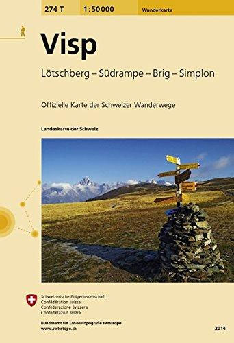
Visp area, map No. 274T, at 1:50,000 in a special hiking edition of the country’s topographic survey, published by Swisstopo in cooperation with the Swiss Hiking Federation. Coverage extends southwards from the Rhone Valley and Brig to include the lower part of the Mattertal beyond Grรคchen and St. Niklaus, the lower part of the Saastal and the Simplon Pass.Cartography, identical to the standard version of the survey, is highly regarded for its superb use of graphic relief and hill shading to provide an almost 3-D picture of Switzerland`s mountainous terrain. Contours are at 20m intervals. An overprint highlights routes maintained by the SHF, distinguishing between hiking routes, mountain routes requiring proper footwear, and alpine routes where equipment is needed. Paths which are part of the national or regional network of long-distance hiking routes are specially marked and in the more recent editions are annotated with their official numbers. The maps show mountain huts, refuges and in remote areas also inns, plus roads with bus service and the positions of bus stops. All the maps have a 1-km grid of the Swiss national coordinates.For a list of all the titles in this series, please click on the series link.

Related Products:
 Simplon – Brig – Visperterminen – Gondo Swisstopo Hiking 3319T
 Zermatt – Saas Fee – Grachen – Visp – Simplon K+F Hiking Map 24
 Nationalpark Swisstopo Hiking 459T
 Unterengadin / Lower Engadine – Zernez – Scoul – Sent Swisstopo Hiking 3327T
 Col du Marchairuz Swisstopo Hiking 460T
 Baden Swisstopo Hiking 215T
 Arbon Swisstopo Hiking 217T
 Tarasp Swisstopo Hiking 249T
 Bulle Swisstopo Hiking 252T
 Gantrisch Swisstopo Hiking 253T
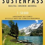 Sustenpass Swisstopo Hiking 255T
 Nufenenpass Swisstopo Hiking 265T
 Delรฉmont Swisstopo Hiking 223T
 Zurich Swisstopo Hiking 225T
 Sardona Swisstopo Hiking 247T
Liestal Swisstopo Hiking 214T
Sardona Swisstopo Hiking 247T
Liestal Swisstopo Hiking 214T
 Frauenfeld Swisstopo Hiking 216T
 Olten Swisstopo Hiking 224T
 Rapperswil Swisstopo Hiking 226T
Willisau Swisstopo Hiking 234T
Rapperswil Swisstopo Hiking 226T
Willisau Swisstopo Hiking 234T
 Lachen Swisstopo Hiking 236T
 Val de Travers Swisstopo Hiking 241T
 Avenches Swisstopo Hiking 242T
 Bern Swisstopo Hiking 243T
Escholzmatt Swisstopo Hiking 244T
Bern Swisstopo Hiking 243T
Escholzmatt Swisstopo Hiking 244T
 Klausenpass Swisstopo Hiking 246T
 La Sarraz Swisstopo Hiking 251T
Safiental Swisstopo Hiking 257T
San Bernardino Swisstopo Hiking 267T
Malcantone Swisstopo Hiking 286T
La Sarraz Swisstopo Hiking 251T
Safiental Swisstopo Hiking 257T
San Bernardino Swisstopo Hiking 267T
Malcantone Swisstopo Hiking 286T
 Montana Swisstopo Hiking 273T
Disentis / Mustรฉr Swisstopo Hiking 256T
Montana Swisstopo Hiking 273T
Disentis / Mustรฉr Swisstopo Hiking 256T
 Clos du Doubs Swisstopo Hiking 222T
 Vallon de St-Imier Swisstopo Hiking 232T
 Valle Leventina Swisstopo Hiking 266T
 Valle Antigorio Swisstopo Hiking 275T
Prรคttigau Swisstopo Hiking 248T
Basel – Sundgau – Blaueberg – Gempen Swisstopo Hiking 213T
Valle Antigorio Swisstopo Hiking 275T
Prรคttigau Swisstopo Hiking 248T
Basel – Sundgau – Blaueberg – Gempen Swisstopo Hiking 213T
 Walenstadt Swisstopo Hiking 237T
 St-Maurice Swisstopo Hiking 272T