Disclosure : This site contains affiliate links to products. We may receive a commission for purchases made through these links.
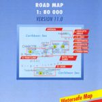
Virgin Islands Borch

British and US Virgin Islands at 1:80,000 on a waterproof and tear-resistant, indexed tourist map from Borch with street plans of The Valley, Road Town, Charlotte Amalie, Cruz Bay, Christiansted and Frederiksted.On one side are the US Virgin Islands showing St. Croix, St. Thomas and St John with the surrounding smaller islands. Insets show street plans of Charlotte Amalie, Cruz Bay, Christiansted and Frederiksted.On the reverse are the British Virgin Islands: Jost Van Dyke, Tortola, Virgin Gorda, Anegada, including the islands south of the Sir Francis Drake Channel. Street plans show The Valley (Spanish Town) and Road Town.Both maps of the islands and the street plan are indexed and highlight selected accommodation and various places of interest including beaches, windsurfing/scuba diving/snorkelling sites, etc. Topography of the islands is shown by relief shading. National Parks and other protected areas are highlighted. Also provided are climate charts, plus a map of the whole of the Caribbean. All the information includes English.

Related Products:
 Virgin Islands (US and British)
 Virgin Islands (US and British) ITMB
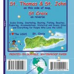
 A23 Virgin Islands and St Croix
 A231 Virgin Islands: St Thomas to Virgin Gorda
 Imray Chart A231: Virgin Islands St Thomas to Virgin Gorda: 2019
 US Virgin Islands Adventure and Dive Map/Guide
 Caribbean Islands East & South ITMB Travel Atlas
 Imray Chart A233: Virgin Islands Double-sided sheet combining charts A231 and A232: 2019
 A233 Virgin Islands (Charts A231 and A232 back-to-back without text)
 A232 Virgin Islands: Tortola to Anegada
 Cruising Guide to the Virgin Islands 2017/18
 British Virgin Islands Franko`s Map-Guide
 Fodor`s U.S. & British Virgin Islands
 Imray Chart A232: Virgin Islands Tortola to Anegada: 2019
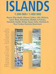 Hawaiian Islands Borch
 Caribbean – Central America – Virgin Islands – Bahamas
 Virgin Islands (GB/USA) Flexi Map OUT OF PRINT
 Puerto Rico, the Spanish, US and British Virgin Islands
 Puerto Rico & US Virgin Islands ITMB
 Grenada to the Virgin Islands – Cruising Guide
 British Virgin Islands Civil Ensign – 1yd – Printed
 British Virgin Islands Civil Ensign – 2yd – Printed
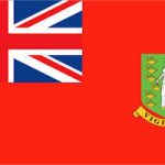 British Virgin Islands Civil Ensign – 1yd – Sewn
 British Virgin Islands Civil Ensign – 2yd – Sewn
 British Virgin Islands Civil Ensign – 1/2 yard – Printed
 NOAA Chart 25641 – Virgin Islands’”Virgin Gorda to St. Thomas and St. Croix – Krause Lagoon Channel
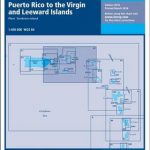 A2 Puerto Rico to the Virgin and Leeward Islands
 Watsonville – Santa Cruz – Scotts Valley CA
 Frommer`s EasyGuide to Virgin Islands
 Cruising Guide to the Virgin Islands
 Reg 12.1 Virgin Islands
 Lisbon Borch
 Okinawa & the Ryukyu Islands Periplus Travel Map
 Admiralty Chart 2020 – Harbours and Anchorages in the British Virgin Islands
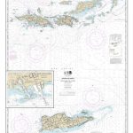
 NOAA Charts for Puerto Rico and Virgin Islands
 US Virgin Islands (American) Flag – 1/2 yard – Printed
 Canary Islands
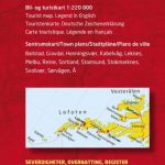 Lofoten and Vesteralen Islands
 Cayman Islands & Jamaica ITMB
 Venice Borch