Disclosure : This site contains affiliate links to products. We may receive a commission for purchases made through these links.
Categories
-
Best Sellers
-

Insight Guides Ireland (Travel Guide with Free eBook)
Insight Guides Ireland Travel made easy. Ask local experts.Comprehensive travel guide packed with inspirational photography and fascinating cultural insights, now with free eBook.From deciding when to Read More » -
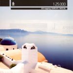
Santorini Terrain Editions 313
Santorini at 1:25,000 on a contoured, GPS compatible hiking map published by Terrain Cartography group together with Skai Maps, and printed on light, waterproof and tear-resistant Read More » -

Dartmoor South Devon Cycling Country Lanes & Traffic-Free Family Routes
These are circular routes and family traffic-free cycling trails with clear, easy to follow maps. National Cycle Network Routes are shown as are well researched local Read More » -
Magdeburg Topo Map 10
-

Earth And The Universe – World Of Wonder
What are the highest and deepest places on earth? What causes earthquakes? How thick is the atmosphere? What is the largest planet in the solar system? Read More » -

Strandir
Strandir, map no. 8, in the topographic survey of Iceland at 1:100,000 published by Mรกl og menning, with excellent, vivid presentation of the terrain, footpaths and Read More » -
Puebla City Plan
Detailed street map of Puebla City, distinguishing several types of roads from divided highways to minor roads. Shows numbered highways, districts, airports, public buildings, hospitals, markets, Read More » -

Limburg (B) Province
Limburg Province of Belgium at 1:100,000 in a series of GPS compatible topographic maps from the Nationaal Geografisch Instituut/Institut Gรฉographique National, the country’s national survey organization, Read More » -

Bucegi Mountains
Bucegi Mountains at 1:50,000 on a contoured map from Bel Alpin, highlighting local waymarked hiking routes, listed on the reverse side with markings and timings, plus Read More » -

Monte Rosa – Alagna – Macugnaga 50K IGC Map No. 10
Monte Rosa – Alagna – Macugnaga in a series contoured hiking maps at 1:50,000 with local trails, long-distance footpaths, mountain accommodation, etc. from the Turin based Read More »
-


