Disclosure : This site contains affiliate links to products. We may receive a commission for purchases made through these links.
Vietnam – Laos – Cambodia Wall Map
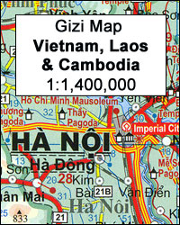
Vietnam, Laos and Cambodia on a wall map at 1:1,400,000 from Gizi Map, size 89 x 124cm (35″ x 49″ approx), with bold altitude colouring providing a vivid picture of the region’s topography, highlighting for places of interest including diving sites, an index of localities, etc.The map shows the road network, including selected local roads and dirt tracks, and gives driving distances on major roads. Railway lines are included and local airports are marked. In each country the map shows names and boundaries of administrative provinces. Vivid presentation of the topography through bold altitude colouring includes plenty of names of mountain ranges, peaks, etc. National parks are highlighted. Various places of interest are marked, including the route of the Ho Chi Minh Trail, diving sites, etc. All place names are in the Latin alphabet. Latitude and longitude lines are drawn at 1ยฐ intervals. The index, separate for each country covered by the map, is on the reverse. Map legend includes English.PLEASE NOTE: this title is also available as a folded map.

Related Products:
 Vietnam – Laos – Cambodia Gizi Map
 Indochina: Vietnam – Laos – Cambodia Reise Know-How
 Thailand, Vietnam, Laos & Cambodia ITMB Travel Atlas
 Vietnam – Laos – Cambodia Nelles
 Vietnam – Laos – Cambodia F&B
 Vietnam, Laos & Cambodia ITMB
 Thailand – Vietnam – Myanmar / Burma – Cambodia – Laos Marco Polo Map
 Vietnam, Cambodia & Laos Insight Travel Map
 Turkmenistan Gizi Wall Map
 Algeria Geographical Wall Map
New Zealand Wall Map
Algeria Geographical Wall Map
New Zealand Wall Map
 Montenegro & North Albania Gizi Wall Map
 China Gizi Map Geographical Wall Map
 Cuba Wall Map
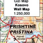 Kosovo Gizi Wall Map
 Saba (Dutch Antilles)
 Red Sea Wall Map
 Saudi Arabia Wall Map
 Mauritania Wall Map
 Aruba
Aruba
 Libya Geographical Edition Wall Map
 Tibet Geographical Edition Wall Map
 Hue – Da Nang & Vietnam Centra ITMB
 Turkmenistan Gizi Map
 Cambodia – the Khmer Legacy Odyssey Illustrated Map
 Iran Wall Map
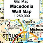 Macedonia Wall Map
 Algeria Road Edition Wall Map
 New Zealand Gizi Map
 Sri Lanka Reise Know-How
 Cambodia Reise Know-How
 China South Wall Map
 Oman and United Arab Emirates Wall Map
 Kazakhstan Geographical Wall Map
 Morocco Wall Map
 Vietnam, Laos & Cambodia Flexi Map
 Hanoi – Vietnam North ITMB
 Curaรงao
 Bhutan Reise Know-How
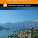 Montenegro